

Posts with tag 'Central Oregon Hikes'
Subscribe and receive email notifications of new blog posts.
 RSS Feed
11
Hike Central Oregon's Clear Lake for Fall Color and Waterfalls
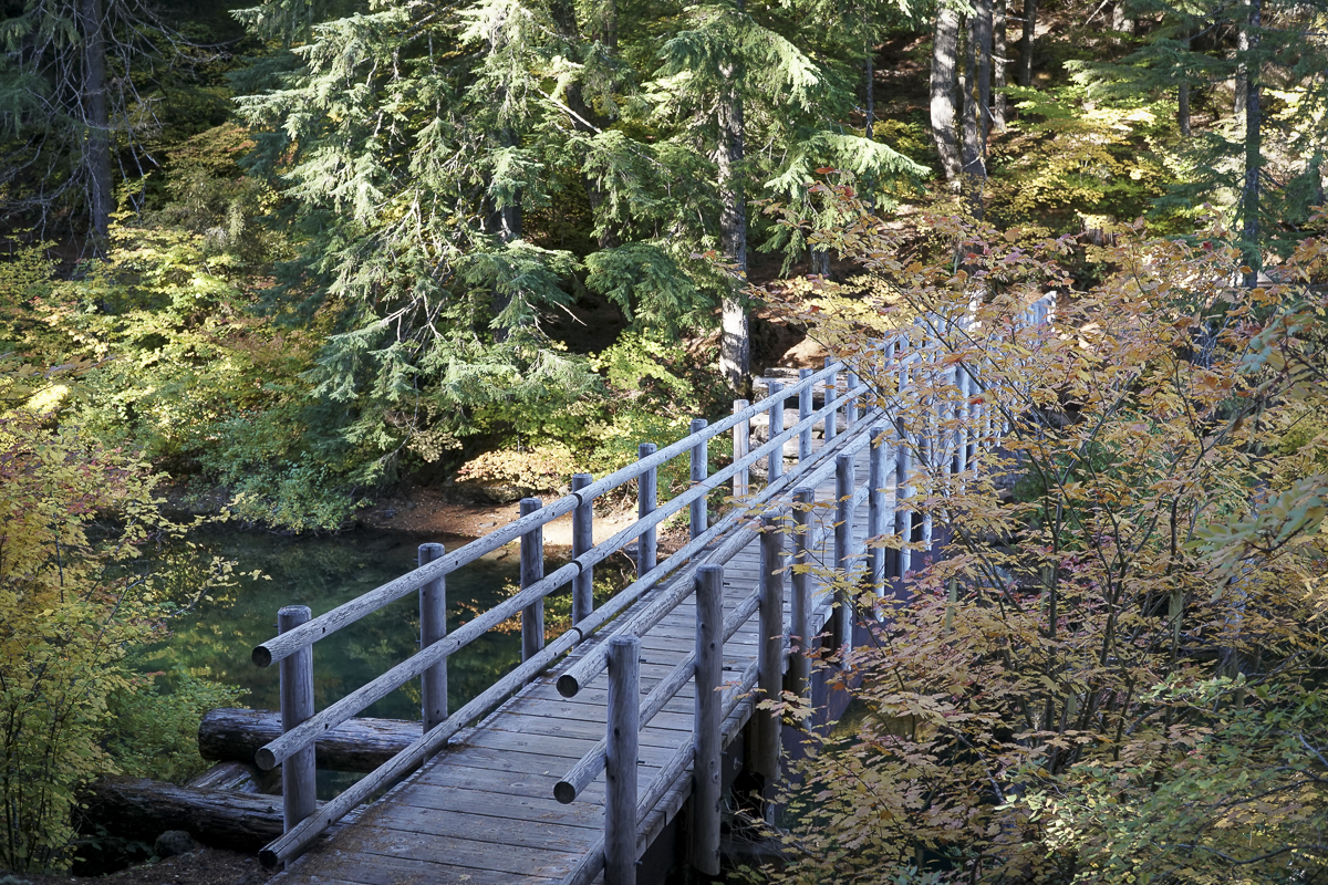
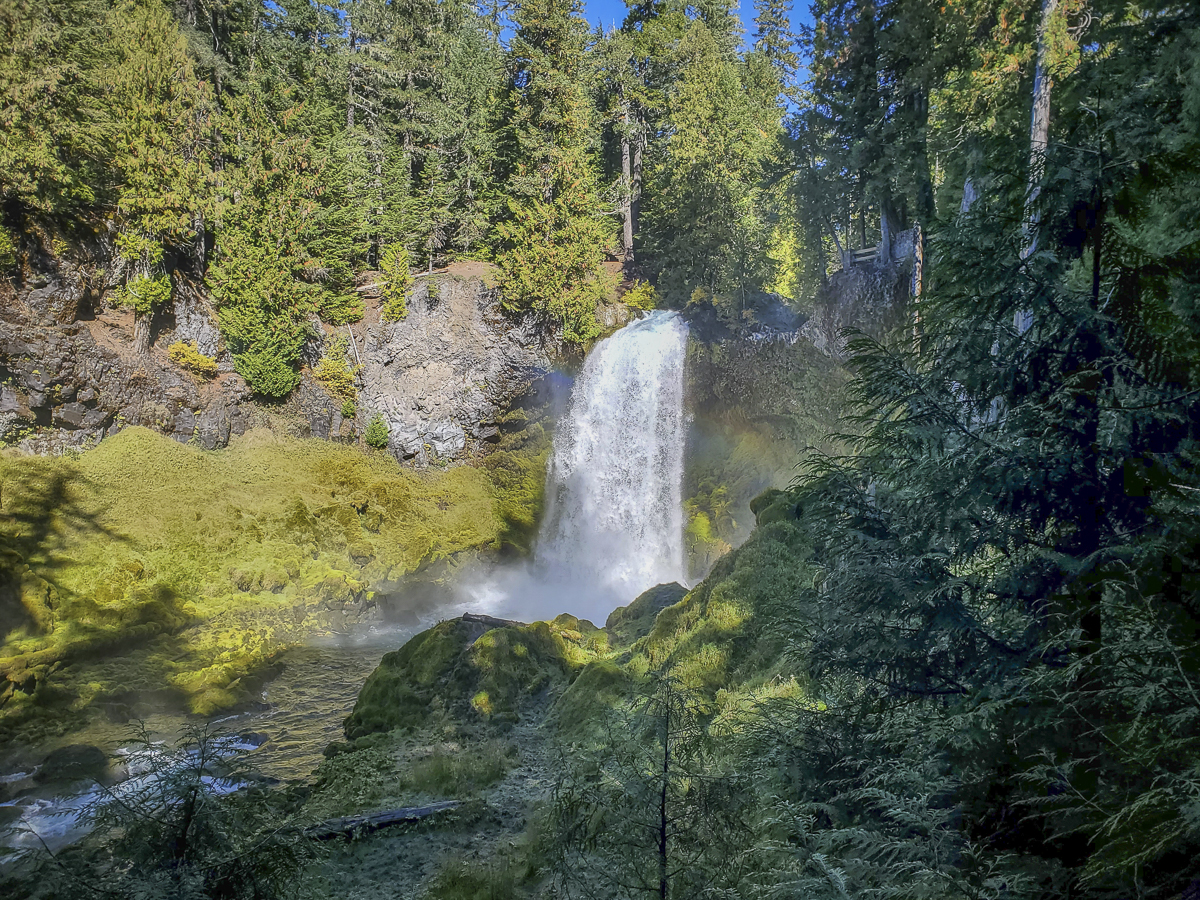
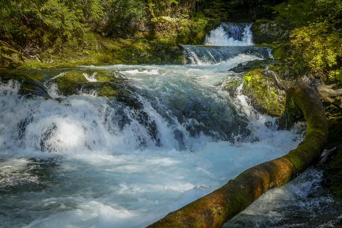
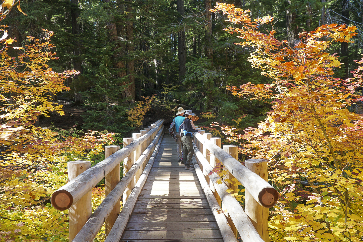
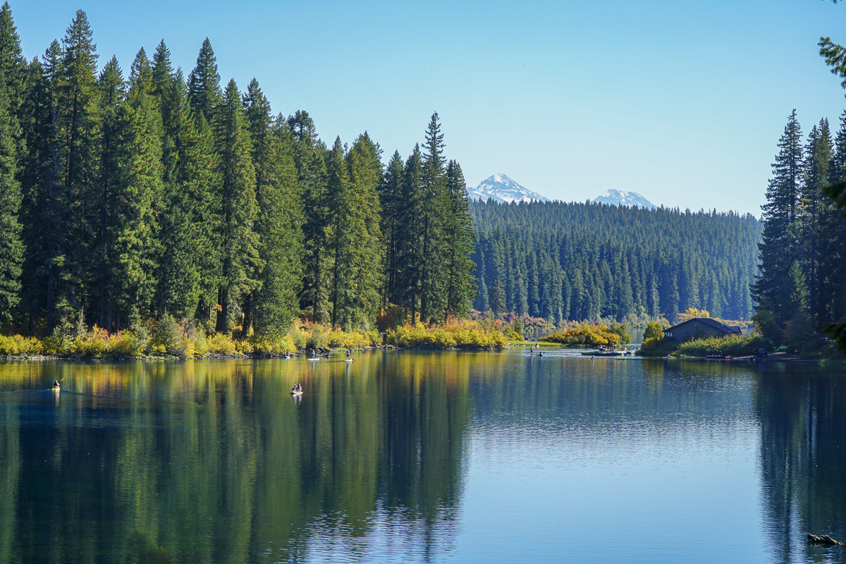
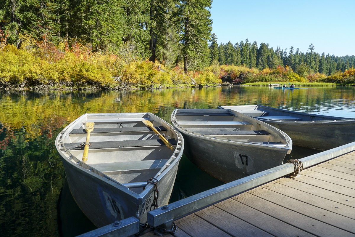
In all the years we have lived in Central Oregon, we have never been to Clear Lake, much less hiked around it. Located off Hwy 126 just south of the junction with Hwy 20 in the Willamette National Forest, the Clear Lake trailhead is next to the parking lot of the Clear Lake Resort where cabins, fishing supplies, boats and kayaks are available for rent. We arrived early before the parking lot filled and started our hike along Clear Lake's western shore. When we reached the southern edge of the lake, we took the cutoff trail to the Sahalie and Koosah Falls loop, which extended our hike and enabled us to view these beautiful waterfalls from the western side as well as the well known eastern viewpoints.
 |
 |
 |
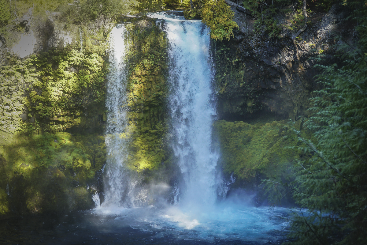 |
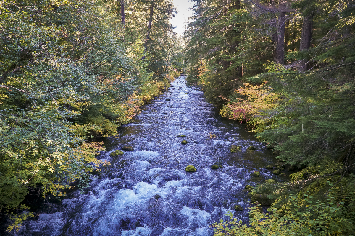
After completing the loop around the falls, we returned to Clear Lake and continued our hike up its eastern edge, passing the spring which is the headwaters of the McKenzie River and the northern edge of the lake. In reading up on Clear Lake, we learned that the lake was formed 3000 years ago when lava from Sand Mountain reached the river and backed up the water to form the lake. Hikers and boaters can still see remnants of the drowned forest in submerged trees still standing under 120 feet of water. The water is near freezing which is why these trees have not fully decomposed after 3000 years.
The northern part of the lake provides for views of North and Middle Sister. It is also here that we saw beautiful reflections in the lake, which at times had a turquoise tint. In returning to the lodge, the parking lot was filled to overflow. Our entire hike, including the waterfall loop, was just less than 10 miles and under 1000 feet of elevation gain. People wishing to see the beautiful colors need to hurry before the leaves fall.
 |
 |
 |
 |
6
Bend Premier Real Estate | October 2023 Newsletter
What's in the October, 2023 Bend Premier Newsletter?
- Bend Home Sales Down While Rate of Price Increase Drops
- Butternut Squash Soup
- Beginning with Pre-Approval
- Hike Pamelia Lake to Grizzly Mountain
- Explaining Today's Low Housing Supply
3
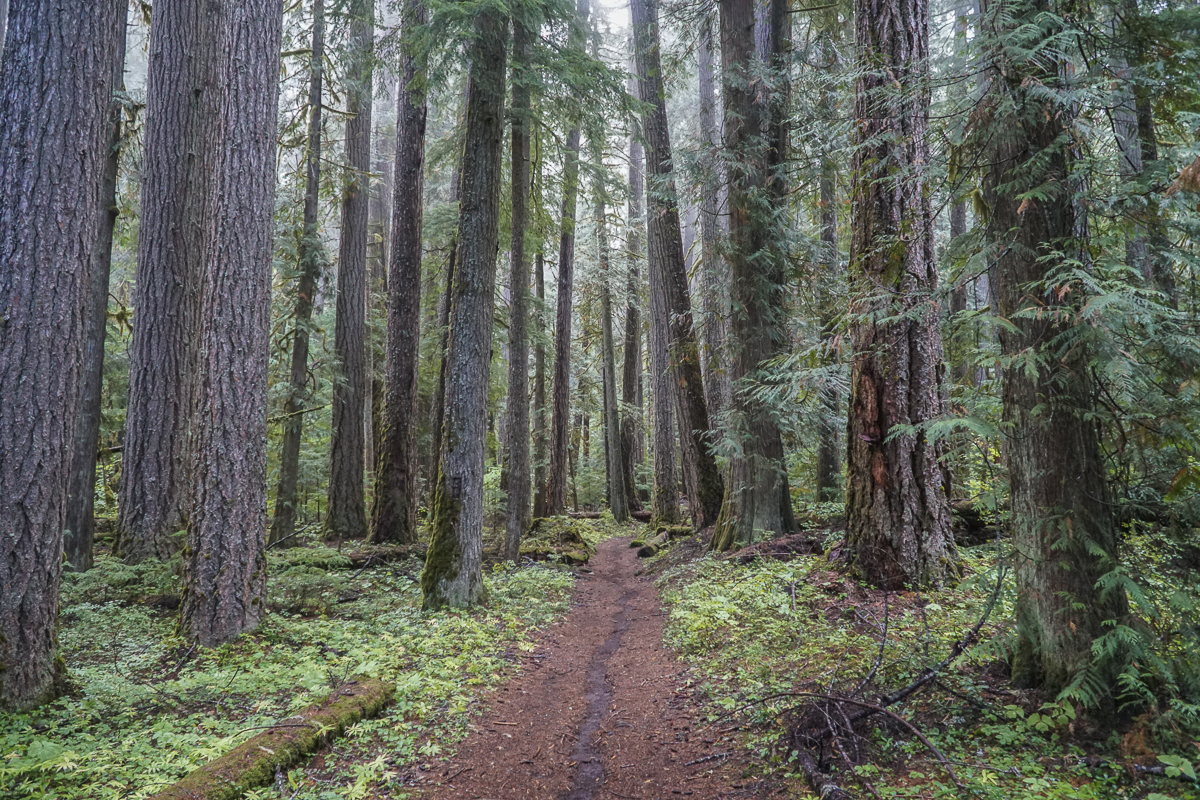
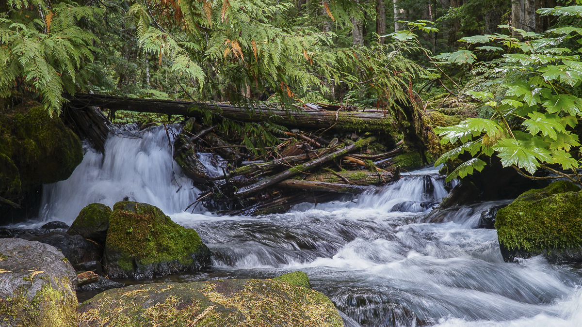
Hike Pamelia Lake to Grizzy Mountain 2023
Pamelia Lake is a Very Popular Hike in the Mt Jefferson Wilderness
Prior to the recent adoption of hiking passes in the last 3 years, Pamelia Lake was one of a handful of Central Oregon hikes requiring a pass to access. This special lake is an easy 2.5 mile hike which gains 550 feet of elevation as it passes through beautiful old growth forest, complete with many rhododendrons which bloom in late spring. Our hike in late September, 2023, included some views of fall color in sunny spaces where vine maple grew. We could also see areas where the 2006 flood from Mt Jefferson's Milk Creek Glacier wiped out portions of the trail and lovely moss covered forest floor. Plant life is returning and the area should eventually fully recover.
 |
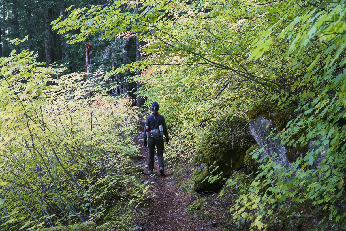 |
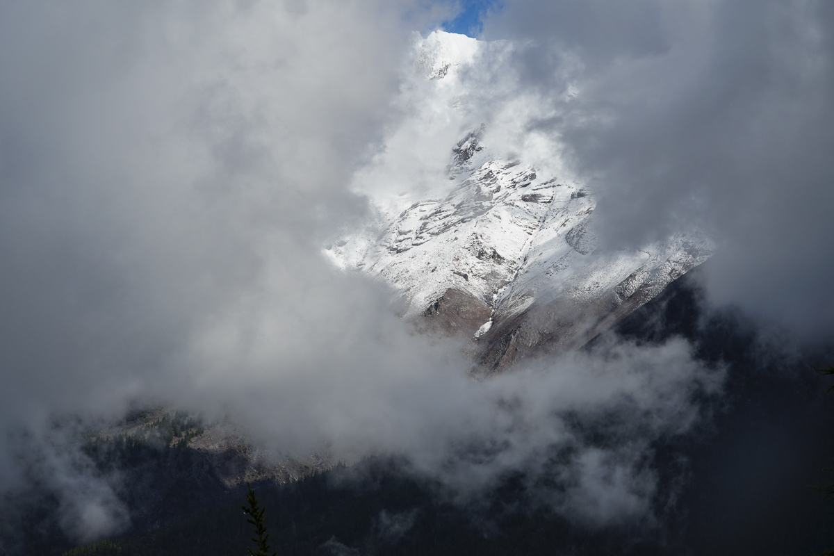
Past the lake, the trail steepens for those planning on summiting Grizzly Mountain. Although over 2200 feet is gained, the path is well graded and doesn't feel as steep as other hikes we have taken in the past. It is another 3.3 miles to reach the top, the entire way in forest with a great viewpoint break roughly .7 miles from the summit. On a clear day, fabulous views of Mt Jefferson should be visible. For us, however, it was cloudy and while peek-a-boo views of Mt Jefferson appeared as the clouds moved, we never saw the entire mountain at once. However, the top of Grizzly Mountain was a great place for a lunch break before we returned back the way we came, enjoying again the hike through the forest with portions of the trail next to lovely Pamelia Creek. Our entire hike was 11.66 miles with 2739 feet of elevation gain. We hope to return next spring to see the rhododendrons in bloom.
 |
 |
22
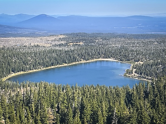
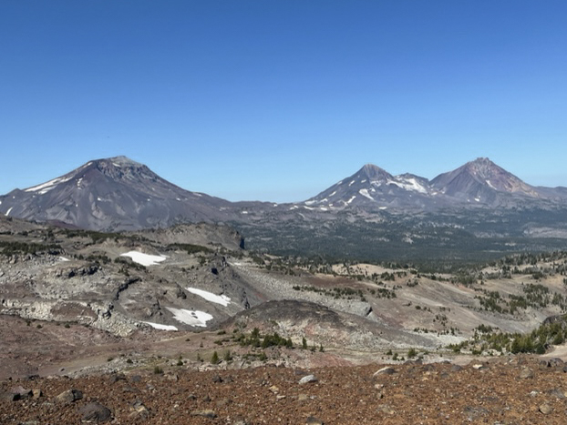
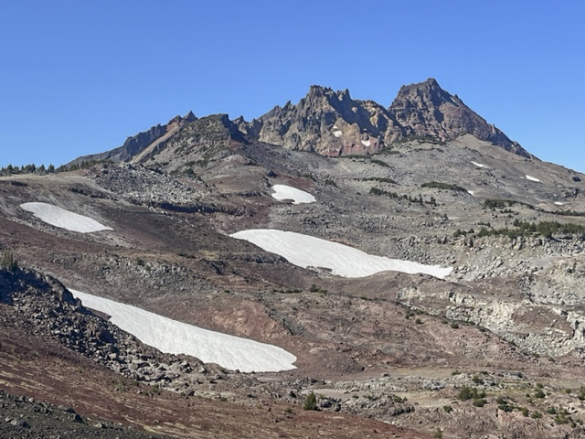
Hike to No Name Lake Via Tam McArthur Rim
Hike Tam McArthur Rim to Broken Top For a Different Approach to No Name Lake
Each year we hike to Broken Top from different trailheads, often arriving at our final destination at No Name Lake, the beautiful glacial aqua blue lake located on the eastern edge of the mountain. One of our favorite hikes includes first a trek to Tam McArthur Rim overlooking Three Creeks Lake outside of Sisters which in itself can be the destination for many. For us, this extended hike passes Tam McArthur Rim on the well marked but "not maintained" trail to Broken Hand and then to the rim overlooking No Name Lake. The total trip for us includes a side trip north of Broken Hand into the safer, but longer path around Broken Hand and then up to the rim. This hike exceeds 10 miles and 2000 feet of elevation gain, but is well worth the trip for the beauty of close views of all Three Sisters and Broken Top. At one point on the hike, views from Mt. Bachelor to Mt Hood are visible - 9 total Cascade Peaks.
 |
 |
 |
 |
8
Bend Premier Real Estate | September 2023 Newsletter
What's in the September 2023 Bend Premier Real Estate Newsletter?
- Bend Real Estate Sales Cooling
- Air Fryer Apple Fritters
- 9 Things You Should Do to Your Home Before Fall Starts
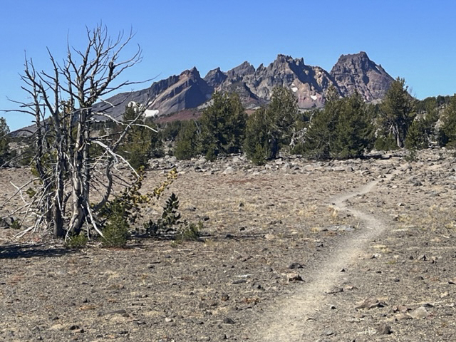
- Crater Rim Trail at Newberry National Volcanic Monument
- Homeowners Have a Lot of Equity Right Now
Privacy Policy / DMCA Notice / ADA Accessibility