(619) 519-1615
Sign Up Login

Posts with tag 'Why We Love Central Oregon'

All Things Central Oregon

Subscribe and receive email notifications of new blog posts.



rss logo RSS Feed
July
31

The Obsidian Trail Never Feels Like the Same Hike Twice

July 28, 2026 • Three Sisters Wilderness • 11.0 Miles • 2100 Feet Elevation Gain

Every mountain has a personality. Some are defined by a summit. Others by a lake or a waterfall. The Obsidian Trail is different. Its personality comes from constant change. On this hike, the scenery transforms every few miles, carrying hikers through recovering forest, volcanic glass fields, alpine meadows, glacial valleys and cascading waterfalls—all in a single day. Having now hiked this trail several times over the years, one thing has become clear. The Obsidian Trail is never the same twice. Our July 28, 2026 hike followed the traditional Obsidian Trail to the Pacific Crest Trail before returning via Glacier Way, the route once used by climbers heading toward Middle Sister. The loop totaled approximately eleven miles with 1,911 feet of elevation gain and, on a quiet Tuesday, we encountered surprisingly few other hikers despite near-perfect weather. Unlike many hikes this summer, smoke from the Akawa Fire stayed well away from the Three Sisters Wilderness on our day, leaving deep blue skies and outstanding mountain views from start to finish.


Entering the Wilderness

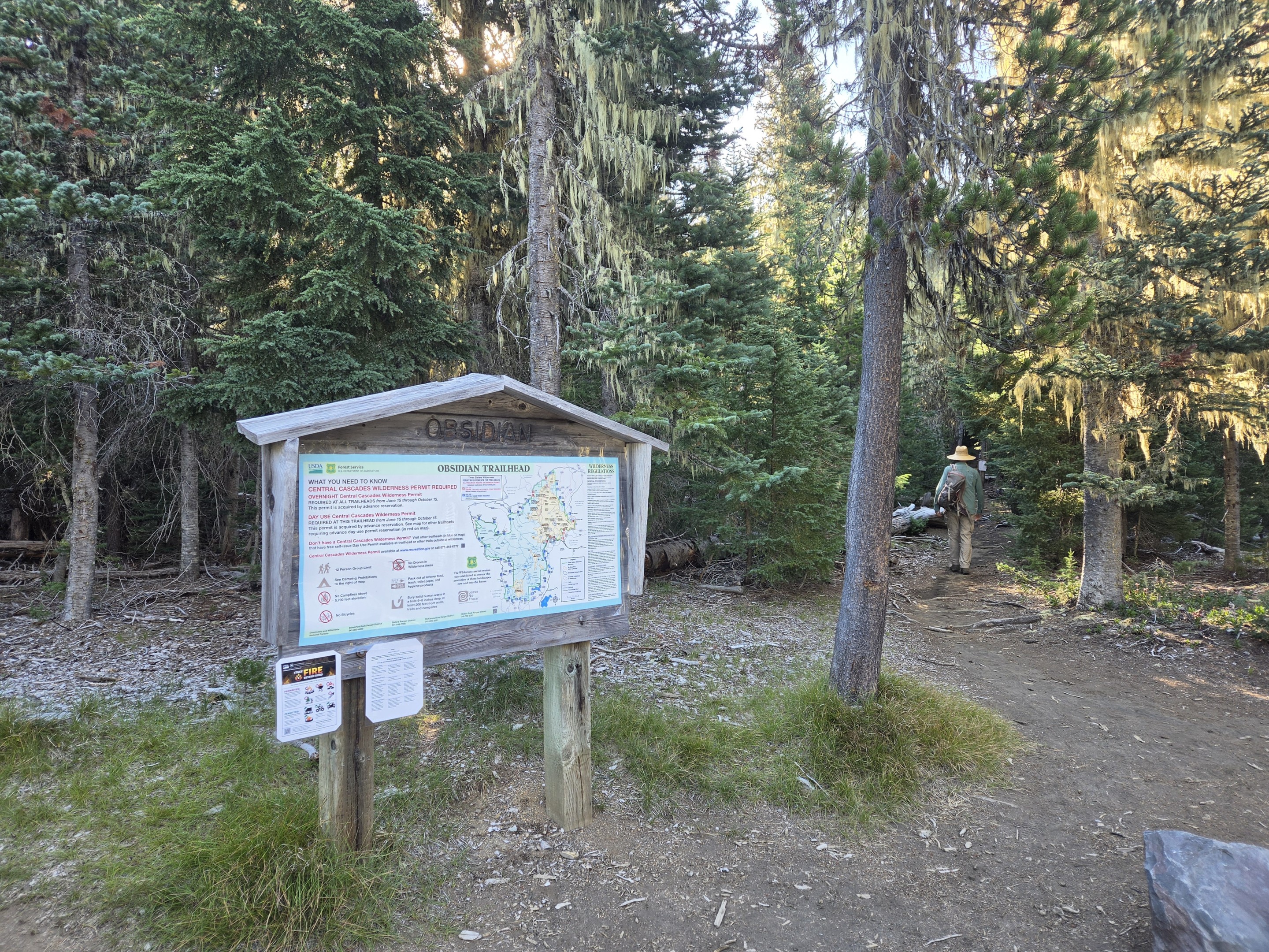
The day begins beneath towering firs at the Obsidian Trailhead off McKenzie Pass Highway. A Central Cascades Wilderness Permit is required for this hike, but once on the trail the sounds of traffic disappear almost immediately. The first miles climb gradually through cool forest where moss hangs from old-growth trees and small streams still provide welcome reminders that water remains close by. It is a peaceful beginning that gives little hint of the dramatic volcanic landscape waiting farther ahead.


A Forest Still Recovering

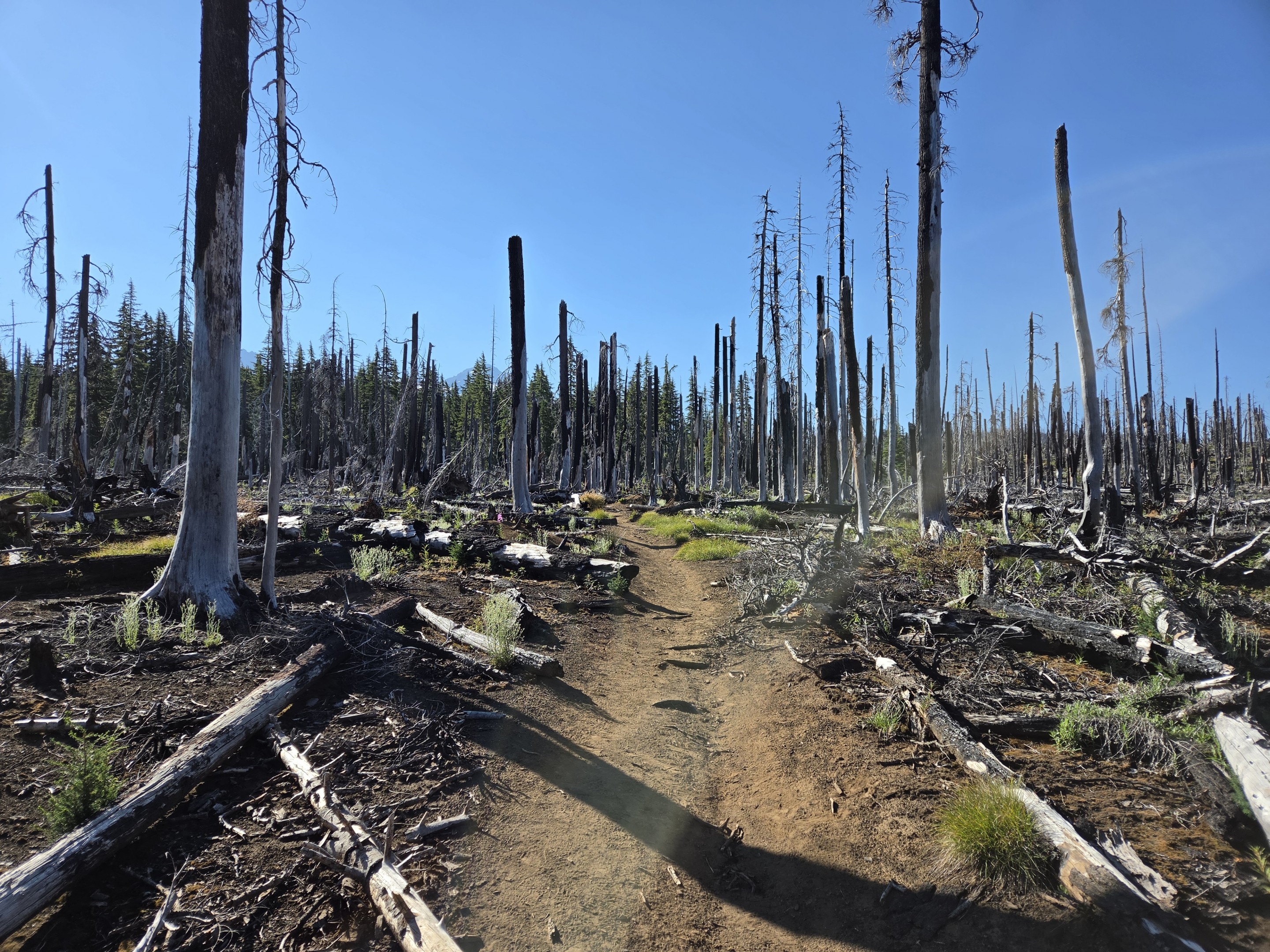
Not long into the hike, the forest changes dramatically. Large sections of standing dead timber remain from the 2003 B&B Complex Fire, one of Oregon's largest recorded wildfires. Charred snags still dominate portions of the landscape, yet the forest floor tells a different story. Young lodgepole pine, wildflowers and grasses continue reclaiming the burned ground, demonstrating just how resilient these mountain ecosystems can be. It is one of the reasons this trail feels so dynamic. Recovery continues year after year, and every visit reveals another chapter in nature's rebuilding process.


Obsidian Falls

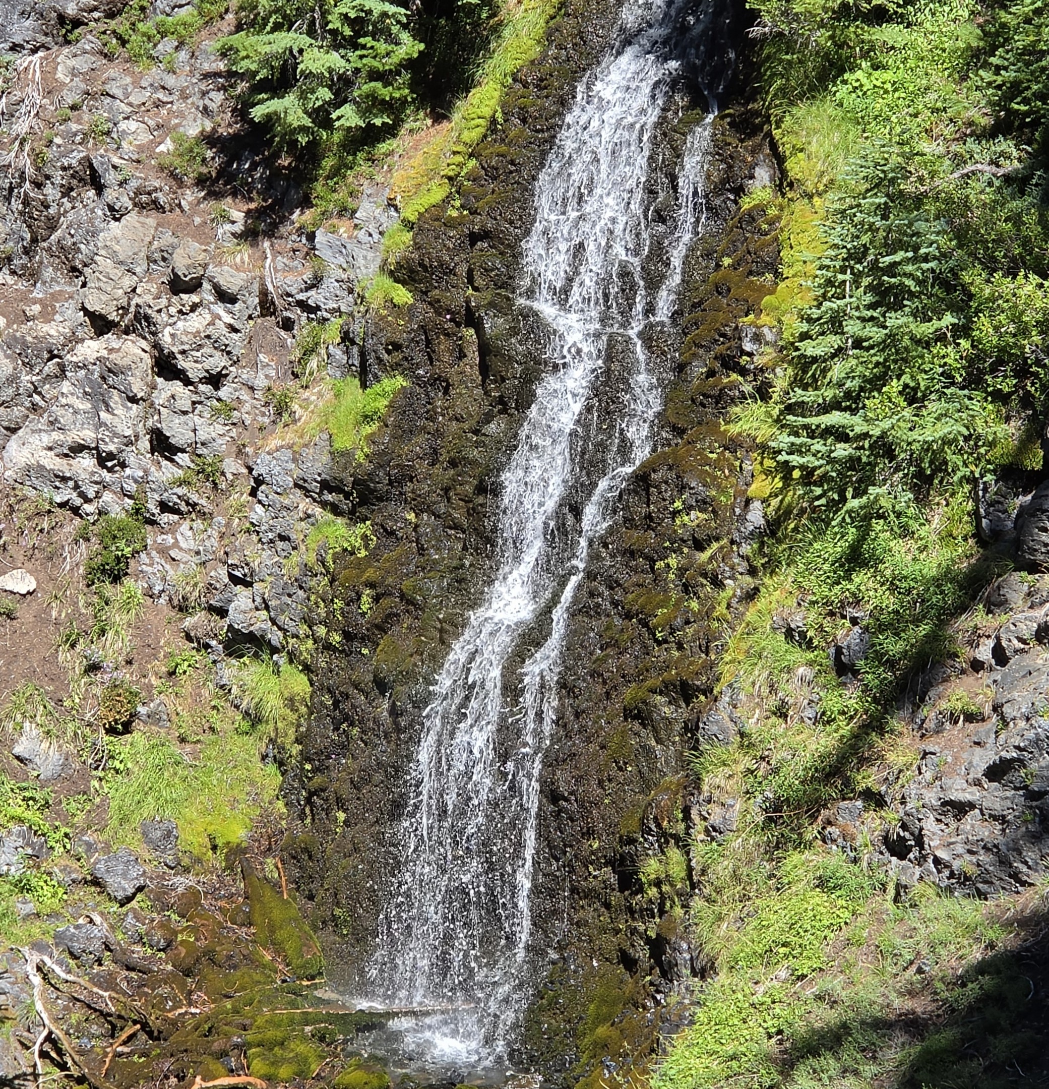
Before leaving the forest behind, the trail reaches one of its hidden gems. Obsidian Falls spills over dark volcanic rock in a cool, shaded canyon, providing one final encounter with abundant flowing water before the landscape becomes increasingly volcanic. The waterfall isn't especially large, but its setting is beautiful and often overlooked by hikers eager to reach the obsidian fields farther ahead. The sound of rushing water accompanies hikers for only a short distance before gradually fading into silence.


Walking Across a Volcanic Glass Field

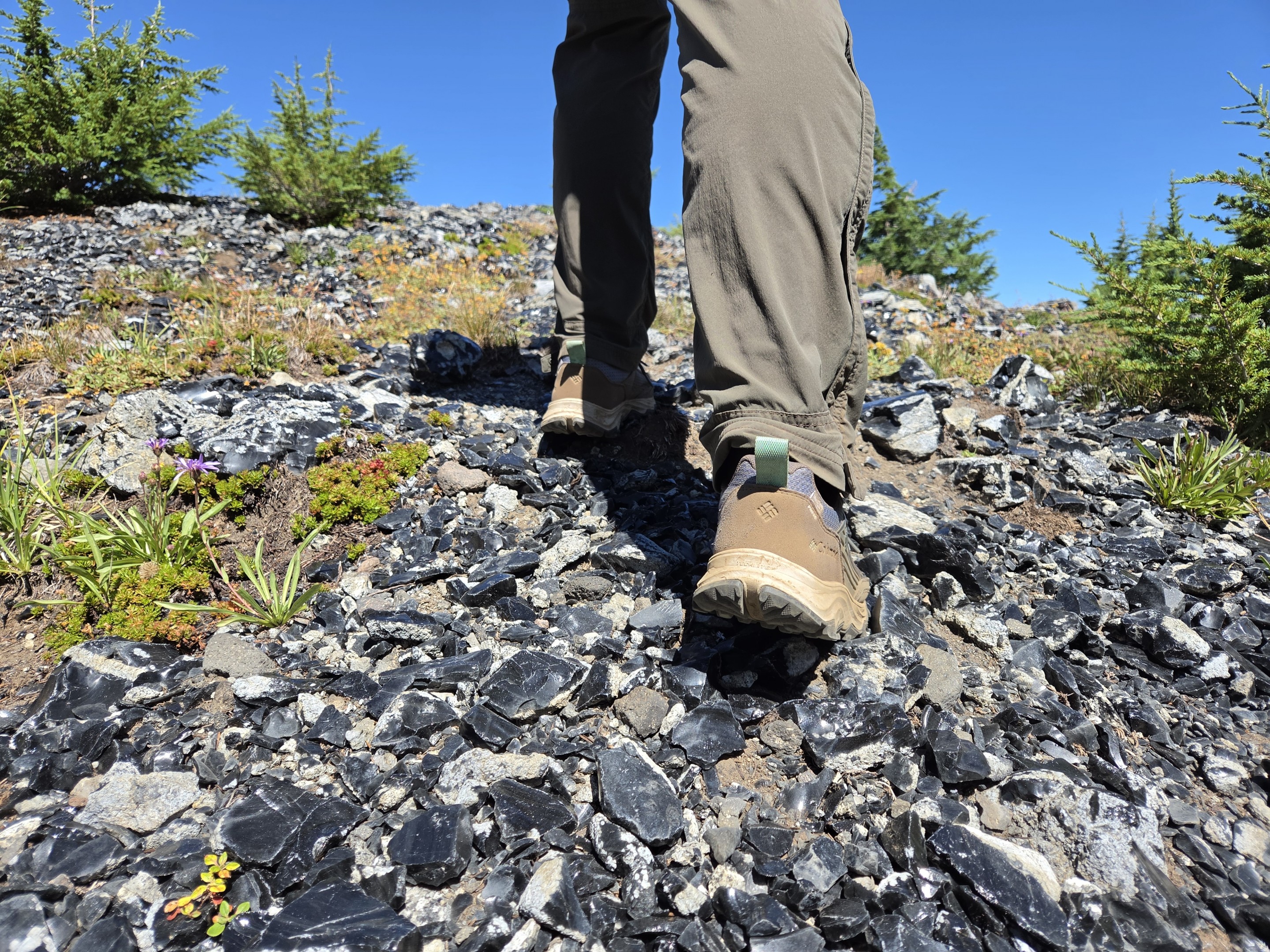
Then the mountain changes again. Dark volcanic glass suddenly covers the ground. Thousands upon thousands of shimmering black obsidian fragments crunch beneath every step, reminders of ancient lava flows that cooled so rapidly they never formed crystals. Unlike many volcanic landscapes in Central Oregon, this one almost feels polished. Sunlight reflects from countless pieces of natural glass scattered across the trail, making every step a reminder that this wilderness was shaped by extraordinary volcanic forces. Few places in Oregon allow hikers to experience volcanic geology this closely while remaining on an established trail.


The Overlook Above the Valley

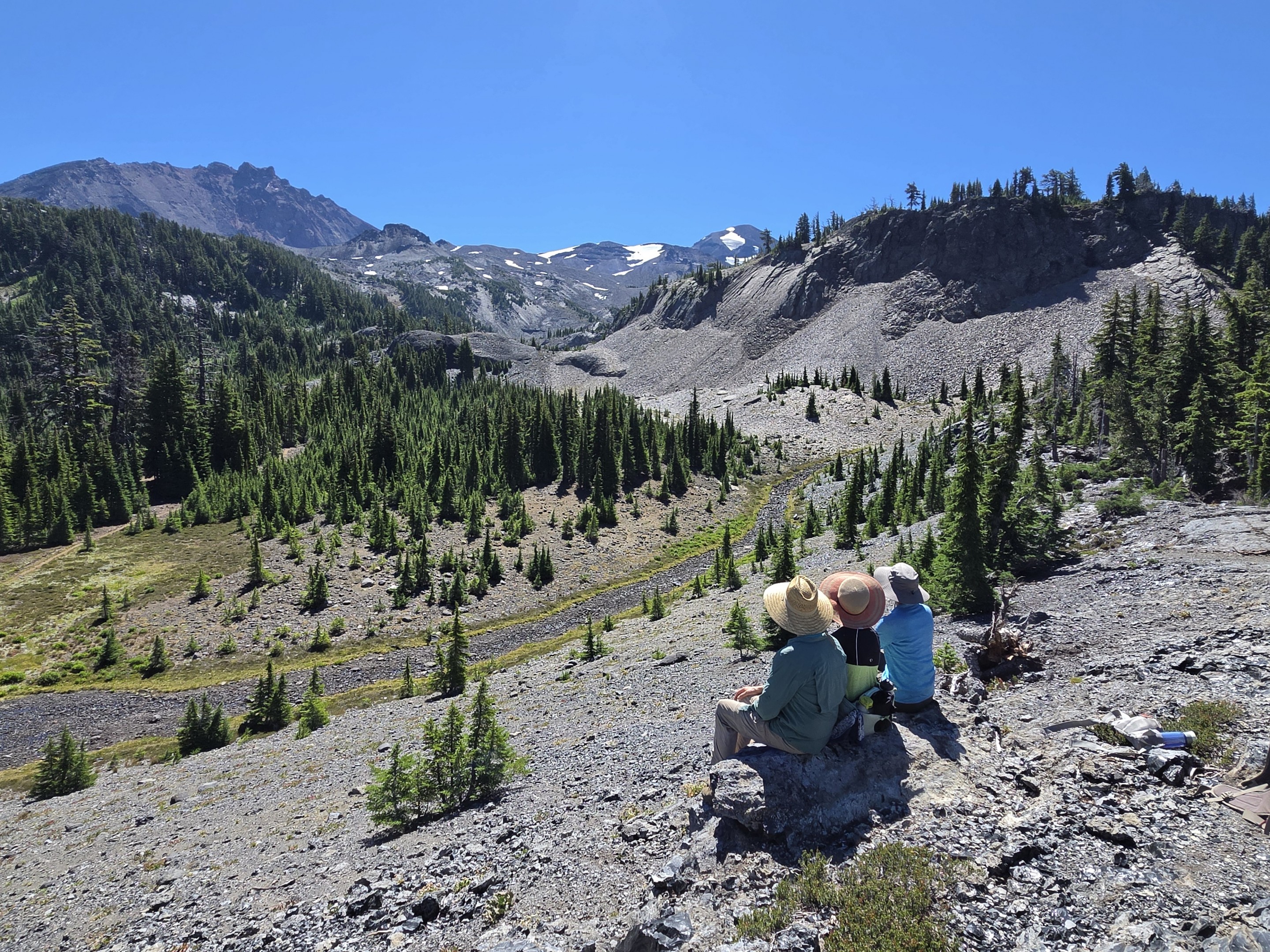
Then, almost unexpectedly, the trail opens onto one of the finest viewpoints in the Three Sisters Wilderness. After climbing through the obsidian fields, the terrain suddenly falls away, revealing an expansive glacial valley framed by North and Middle Sister and the surrounding volcanic ridges. Below lies a broad alpine meadow known as Sunshine, while remnants of ancient glaciers have sculpted the landscape stretching toward the Pacific Crest Trail. We sat on the rocky overlook for quite a while, watching the valley spread out below us. On many hikes, the summit is the destination. Here, there isn't a summit at all—just a place that invites you to stop, catch your breath, and appreciate the scale of the wilderness. On this Tuesday morning we shared the view with very few people, a surprising luxury on one of the Cascade's most celebrated trails.

Sunshine Meadow

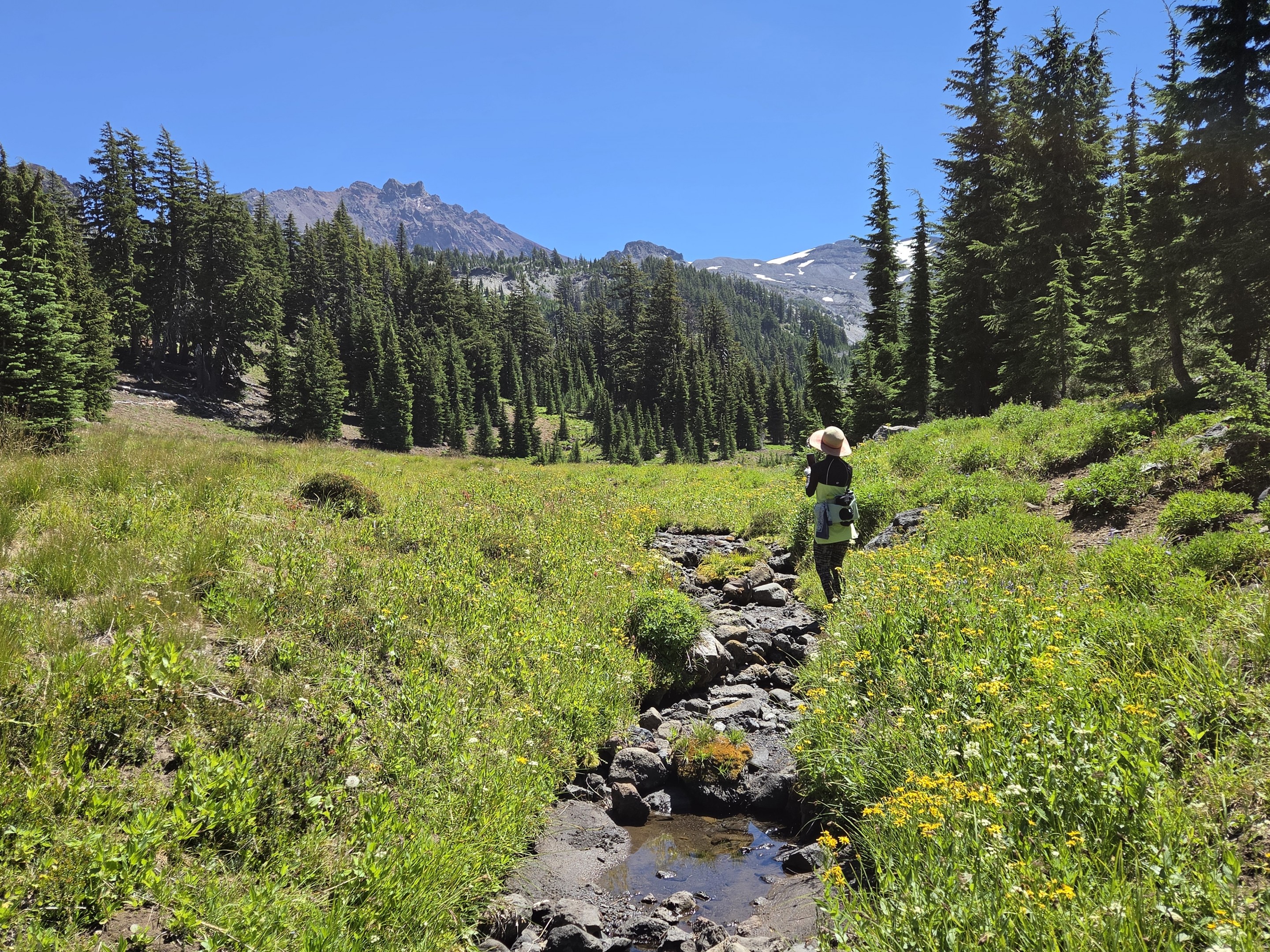
Leaving the overlook, the trail gently descends toward Sunshine Meadow, and the perspective changes completely. What looked expansive from above suddenly becomes intimate. Wildflowers line the edges of the meadow, a narrow spring-fed creek quietly winds through the grasses, and North and Middle Sister towers overhead in a way that photographs can never quite capture. This is where we noticed how different the mountain looked from last summer. Following a relatively dry winter, the creek carried only a fraction of the water we had seen during our 2025 hike. The spring still bubbled from the volcanic rock beneath the overlook, but instead of racing across the meadow, the water wandered lazily through the grass before gradually disappearing into the porous volcanic soil. Watching that little stream simply vanish into the earth was a reminder that these mountains are constantly changing. Even when you return to the same trail, nature writes a different story every year.


Returning on Glacier Way

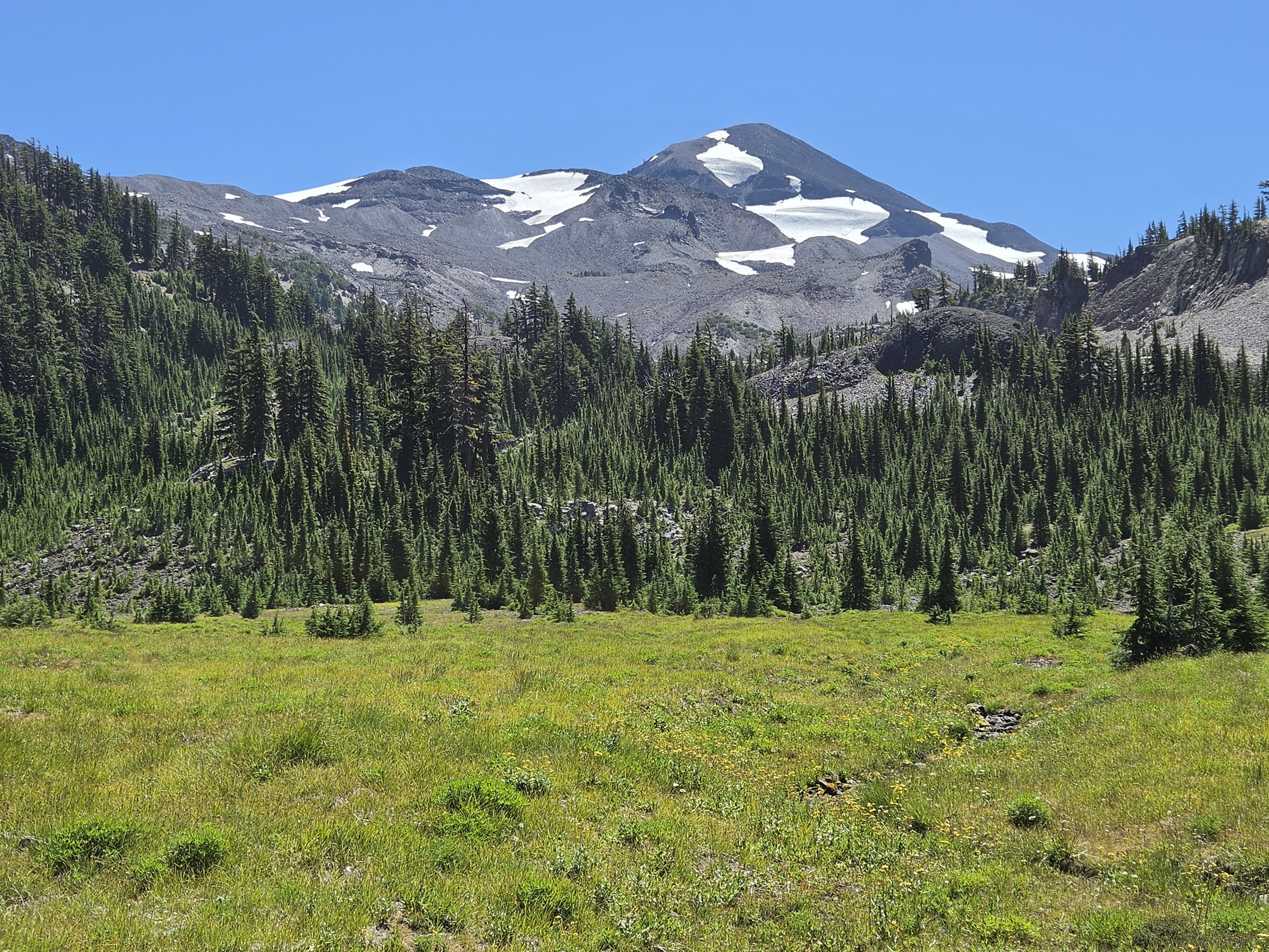
Instead of retracing our steps, we turned onto Glacier Way, the former climbers' route that follows the eastern edge of Sunshine Meadow before gradually descending toward the trailhead. Looking back across the meadow, Middle Sister dominates the skyline while the little spring continues its quiet journey through the grass. It may have been a dry summer, but this remained one of the most beautiful alpine settings in the Three Sisters Wilderness.

The Glacier Way route offers an entirely different experience from the climb up the Obsidian Trail. Moss-covered rock walls, seasonal stream channels and scattered springs reveal where snowmelt normally tumbles down the mountain. This year many of those channels were already dry, making the few remaining pockets of flowing water feel even more special.

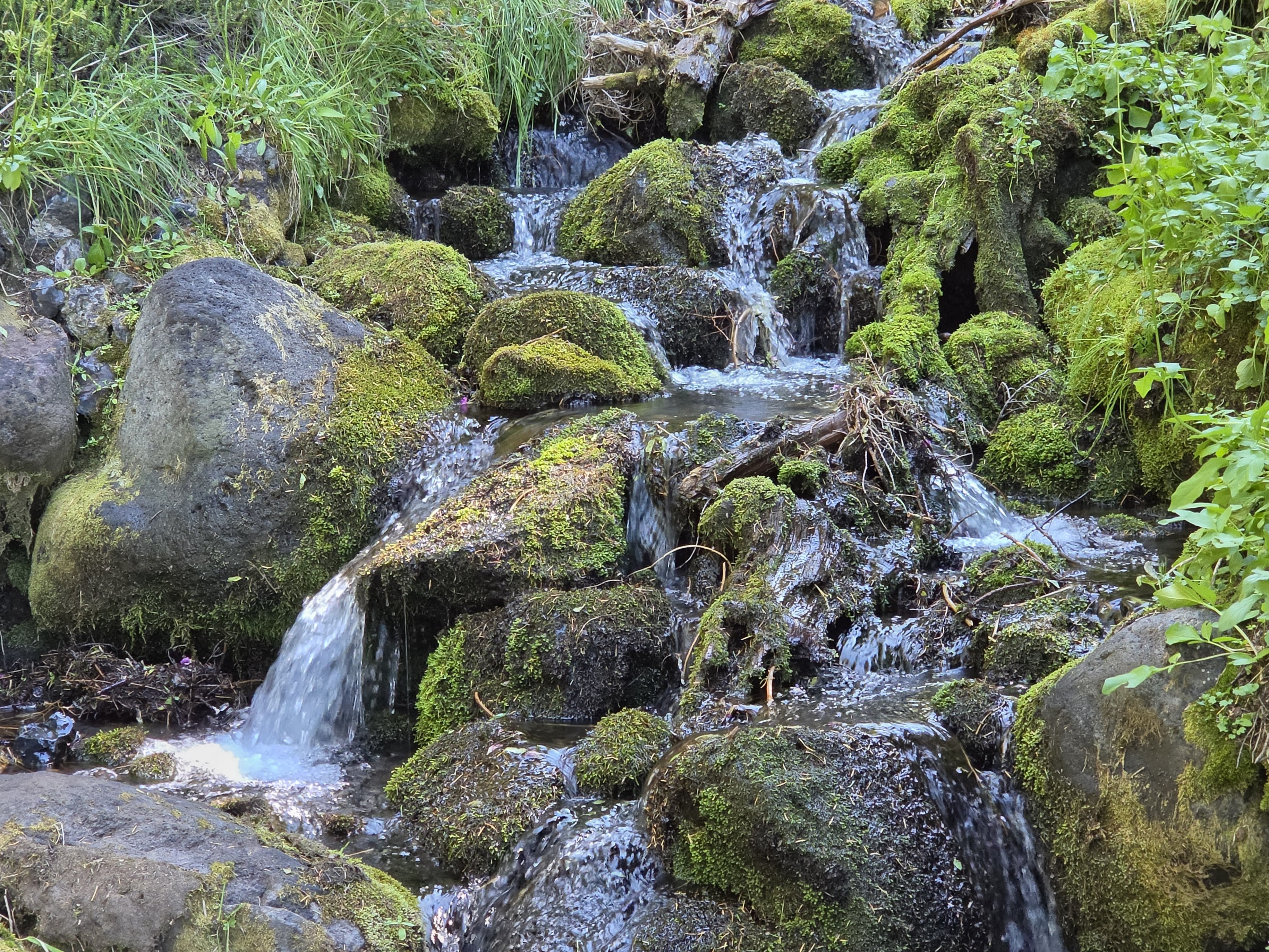
One small spring still spilled over moss-covered rocks beside the trail before disappearing beneath the meadow below—a fitting reminder that water here is never wasted, only hidden.


Why I Keep Returning

Having now hiked the Obsidian Trail multiple times, we've stopped thinking of it as a destination. Instead, we think of it as one of those rare places that rewards repeat visits. Some years the creeks are roaring. Other years they quietly disappear into the meadow. Wildflowers peak at different times. Snow lingers longer—or melts away early. Smoke may obscure distant peaks or, as it did on our July 2026 hike, leave crystal-clear skies that seem almost endless.

The trail changes.

The mountain changes.

Even the experience changes.

That's exactly why hikers keep coming back.

We've now hiked the Obsidian Trail in multiple seasons and over several years. If you're planning your own trip, you may also enjoy our earlier experiences, which highlight different trail conditions, water levels, and perspectives on this remarkable wilderness.


Hiking Statistics

  • Trail: Obsidian Trail / Pacific Crest Trail / Glacier Way Loop
  • Location: Three Sisters Wilderness near McKenzie Pass
  • Distance: 11.0 miles
  • Elevation Gain: 2100 feet
  • Difficulty: Moderate
  • Permit Required: Central Cascades Wilderness Permit
  • Best Season: Mid-July through September, depending on snow conditions
    July
    20

    Beyond the Burn: A Different Way to Reach Golden Lake and Broken Top's Hidden Tarns

    There are two ways to reach Golden Lake in Oregon's Three Sisters Wilderness. The route most hikers know begins at the Green Lakes Trailhead. It's spectacular, climbing steadily toward Green Lakes before crossing the divide into the secluded basin below Broken Top. Unfortunately, it's also one of the most sought-after trailheads in the Central Cascades permit system. Unless you reserve months in advance—or get lucky with a last-minute cancellation—there's a good chance you won't be hiking

    Click Here to Read More...

    July
    14

    Hiking to Collier Glacier from Lava Camp: A Journey Across Oregon's Volcanic Landscape

    Distance: 14.63 miles out-and-back
    Elevation Gain: 2,236 feet
    Trailhead: Lava Camp Lake Trailhead – McKenzie Pass Scenic Highway (Hwy 242)
    Difficulty: Difficult
    Best Time: July through early October (depending on snow)


    Most hikes have one destination. This hike has about six. Beginning at Lava Camp on the historic McKenzie Pass Scenic Highway, the trail to Collier Glacier feels less like one continuous hike and more like walking through the geological story of Central Oregon. Nearly every couple of miles the landscape changes completely—from dense forests to lava flows, peaceful alpine lakes, colorful wildflower meadows, volcanic cinder cones, and finally the stark alpine world beneath the glaciers of North Sister. By the time we returned to the trailhead, our GPS showed 14.63 miles with 2,236 feet of elevation gain, but the distance hardly tells the story.


    Through an Ancient Forest

    The hike begins beneath towering mountain hemlock and fir trees after about a mile of hiking through burnt forest. Unlike many Cascade hikes that immediately begin climbing, this trail eases hikers into the wilderness. Soft forest paths wind through lava rock that has slowly disappeared beneath centuries of moss and soil. Soon enough, glimpses of volcanic peaks begin appearing between the trees, hinting at what lies ahead.
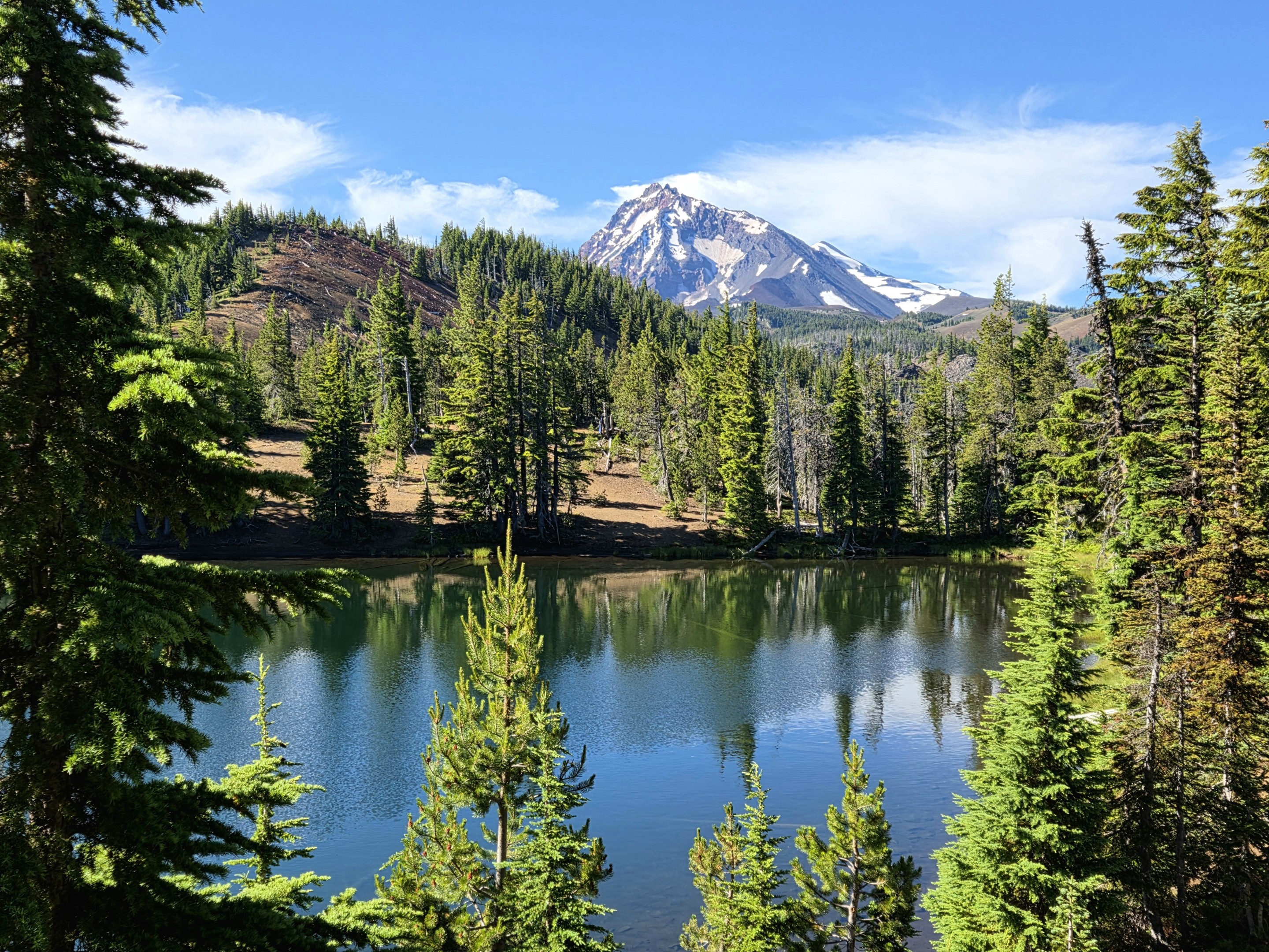

    The first Matthieu Lake is one of the hidden gems along the hike.


    Arriving at the Matthieu Lakes

    One of the first major landmarks is the Matthieu Lakes area, a popular backpacking destination within the Three Sisters Wilderness. The first lake appears almost unexpectedly through the trees. Calm water reflects North Sister while surrounding evergreens frame one of the prettiest alpine scenes along the trail. Camping is carefully managed here to protect this fragile environment.
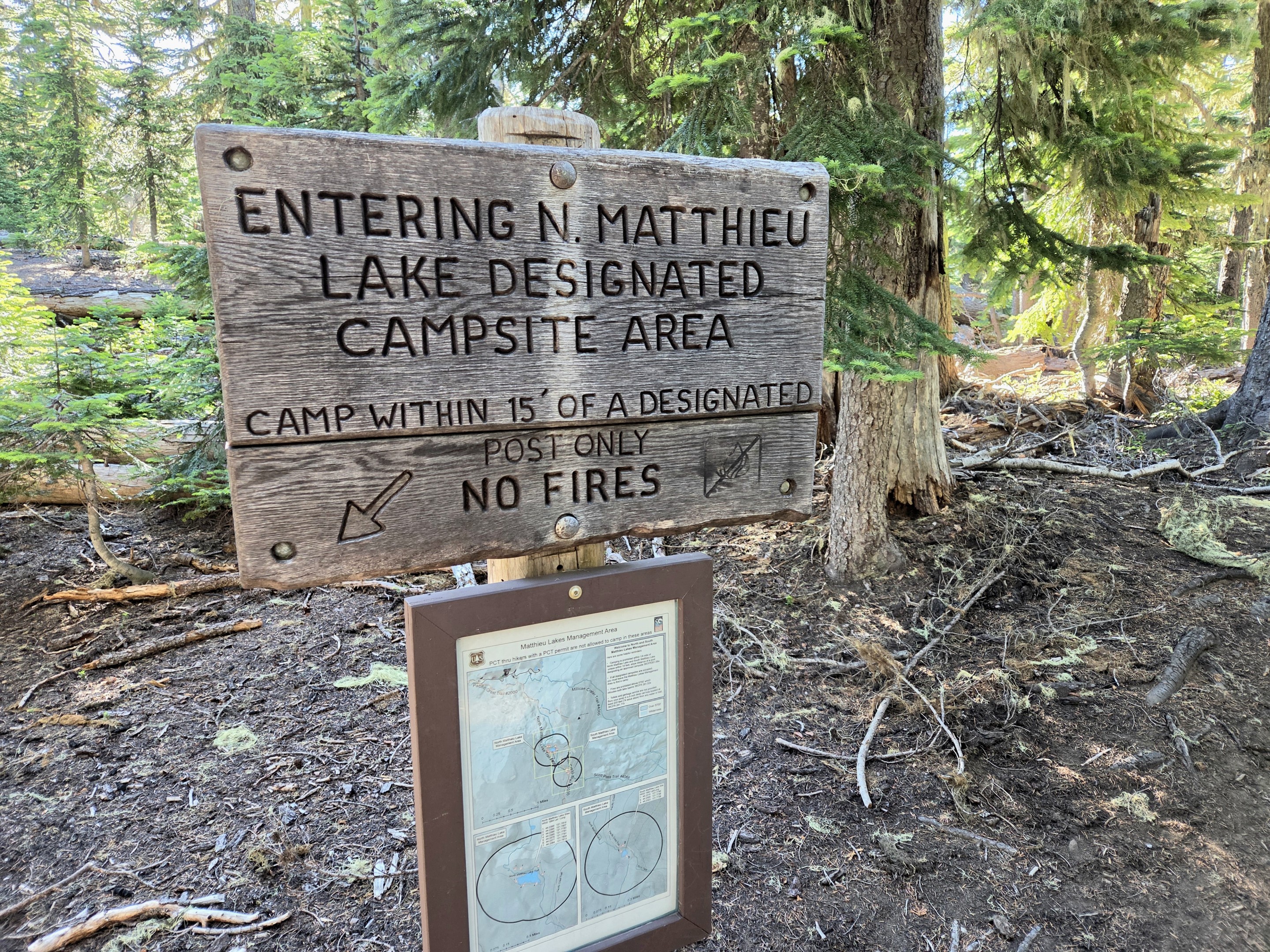

    The Matthieu Lakes are designated camping areas to help preserve this heavily visited wilderness.


    The Forest Suddenly Ends

    Leaving the lakes behind, the scenery begins changing dramatically. The trail climbs onto broad volcanic slopes where lava rock replaces forest floor. Ancient lava flows and black volcanic soils remind hikers that these mountains are still geologically young. Bright clusters of paintbrush provide a striking contrast against the dark volcanic landscape.
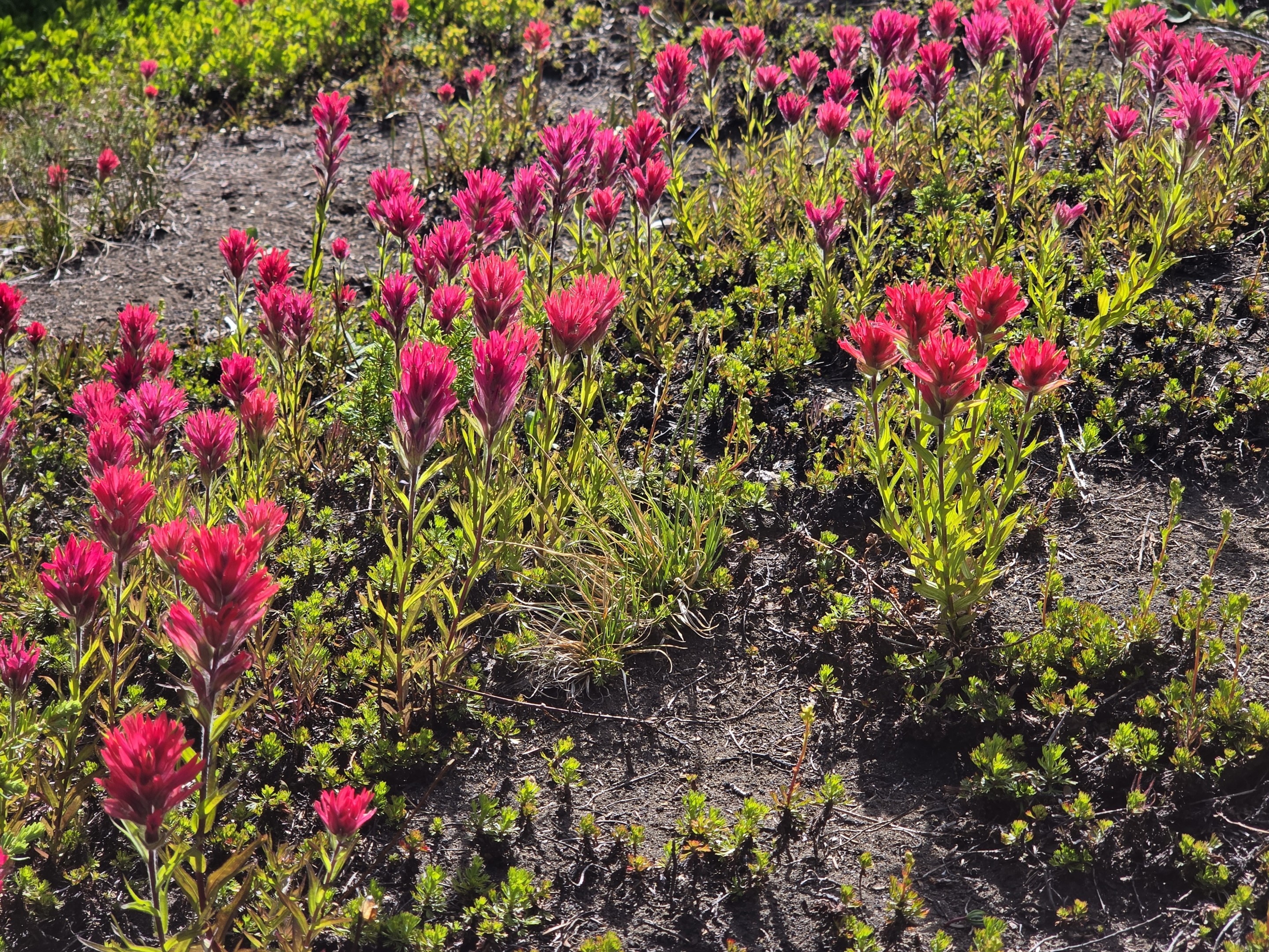

    Brilliant paintbrush adds vivid color to the volcanic terrain.


    A Detour to Yapoah Crater

    One of the unexpected highlights of this hike is passing Yapoah Crater, a broad volcanic crater tucked into the rugged landscape between the Matthieu Lakes and Collier Glacier.Unlike the snow-covered peaks surrounding it, Yapoah Crater is a study in raw volcanic geology. Its steep walls of reddish cinders, dark lava rock, and loose volcanic ash reveal the forces that shaped this entire region thousands of years ago.  Standing along its rim, it's easy to imagine the volcanic activity that once transformed these slopes. While many hikers focus on reaching Collier Glacier, Yapoah Crater is a reminder that this trail isn't simply about glaciers—it's about experiencing nearly every chapter of Central Oregon's volcanic history in a single day.
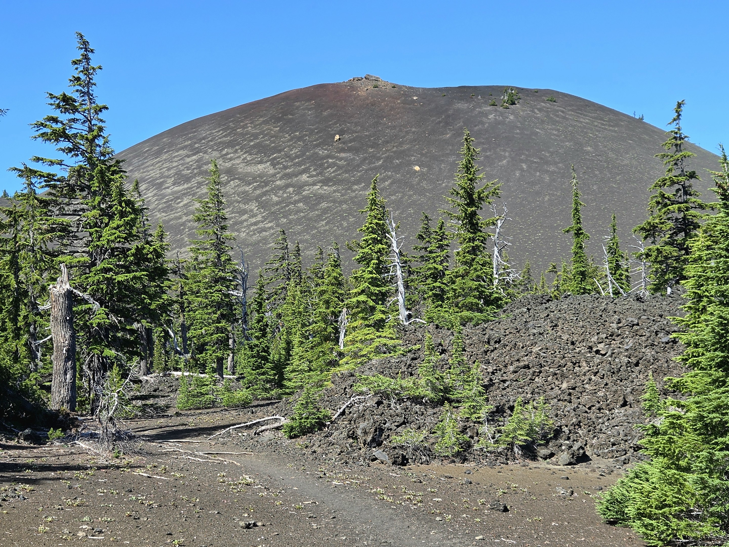
    Yapoah Crater showcases the volcanic forces that built the Three Sisters region long before glaciers carved today's landscape.


    One of the Best Viewpoints in Central Oregon

    As the trail gains elevation, the forest falls away. Suddenly the Cascade skyline opens. From one overlook you can see:

    • Belknap Crater
    • Mount Washington
    • Three Fingered Jack
    • Mount Jefferson
    • Mount Hood

    Stretching across the horizon is nearly the entire spine of Oregon's Central Cascade Range. It is one of those viewpoints where everyone stops—not because the trail requires it, but because the scenery demands it.
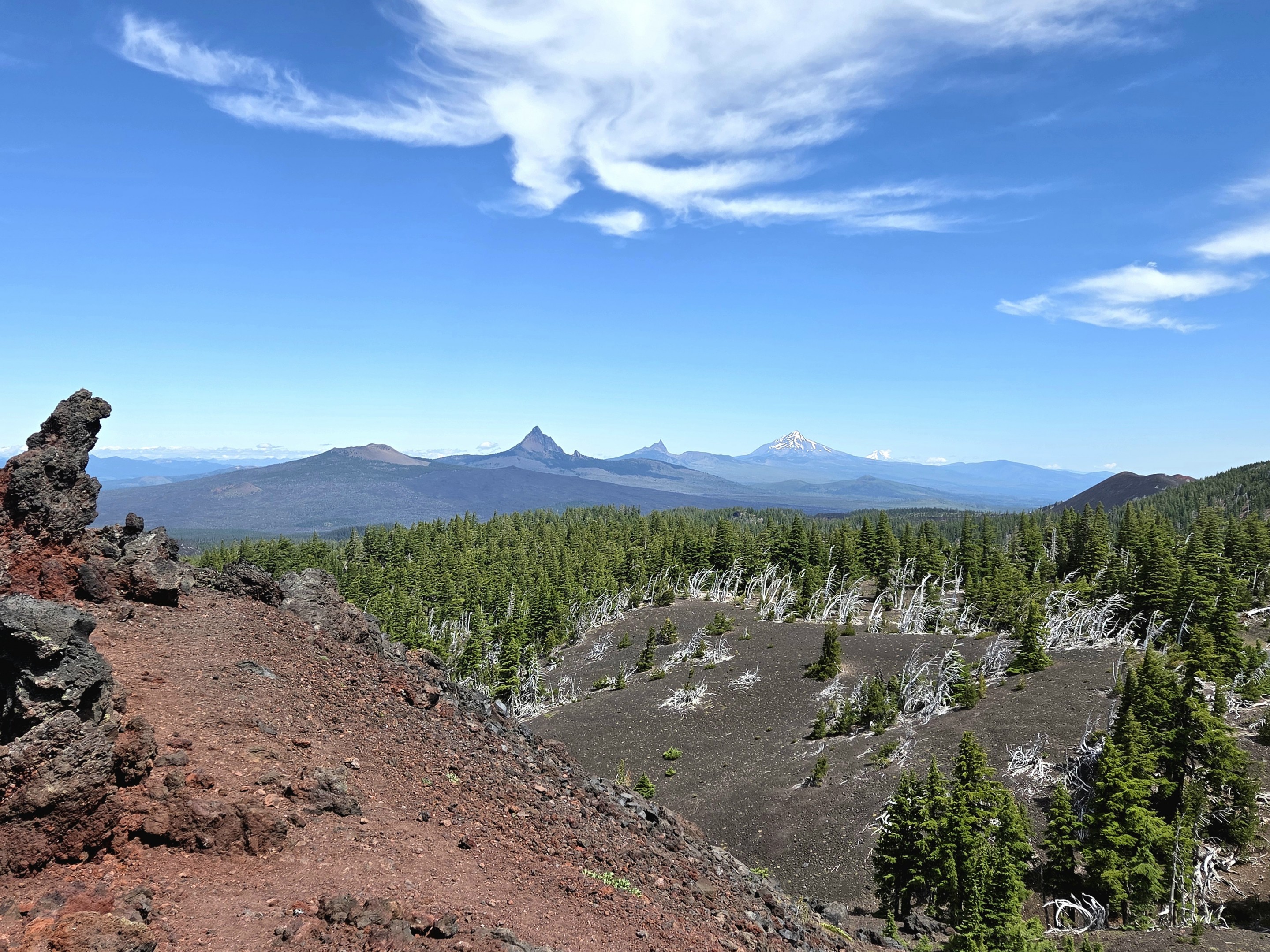

    A remarkable panorama stretches from Belknap Crater to Mount Hood.


    Walking Into Another World

    Leaving Yapoah Crater behind, the trail crosses an expansive volcanic plateau where trees gradually disappear and loose cinders replace forest soil. The landscape becomes increasingly stark, shaped by lava flows, pumice, and glacial erosion. Every step feels like walking across the flanks of an active volcano, with North Sister growing larger as Collier Glacier finally comes into view.
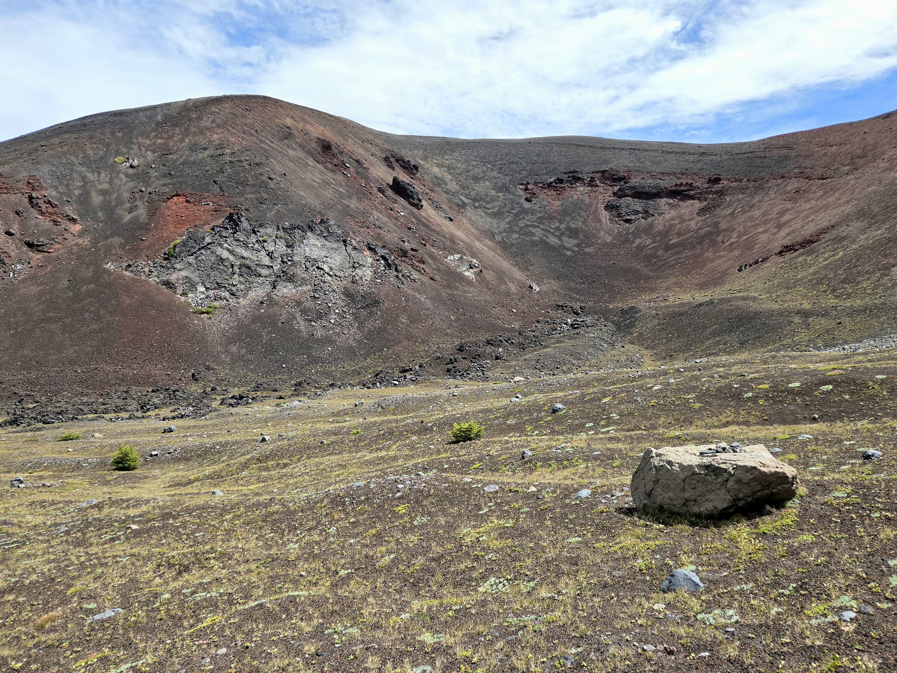

    The landscape becomes increasingly volcanic at Collier Cone approaching Collier Glacier.


    Finally...Collier Glacier

    After miles of changing scenery, North Sister finally dominates the horizon.Below its steep volcanic cliffs sits Collier Glacier, once the largest glacier in Oregon. Although the glacier has retreated dramatically over the last century, viewing the glacial lake is still an unforgettable experience. Snowfields cling to surrounding ridges while freshly melted glacial water fills the basin below and the sound of the running water is unmistakable.

    It feels wild. Remote. Almost untouched. Few day hikes in Oregon place you this close to active glaciers without requiring technical climbing.
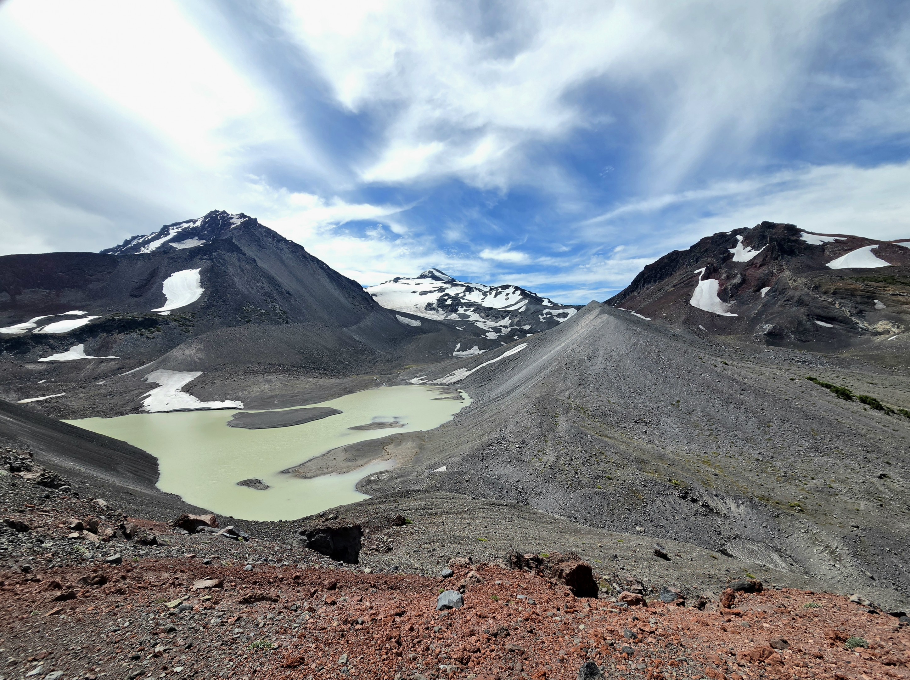

    After more than seven miles, Collier Glacier rewards hikers with one of the most dramatic alpine landscapes in Oregon.


    The Return Hike

    Unlike many hikes where the return feels repetitive, this trail offers an entirely different experience heading back. Afternoon light changes the colors of the volcanic slopes. The Cascade peaks appear from new angles. The forests seem even greener after spending hours above timberline. Every section reveals details that were easy to overlook while hiking toward the glacier.
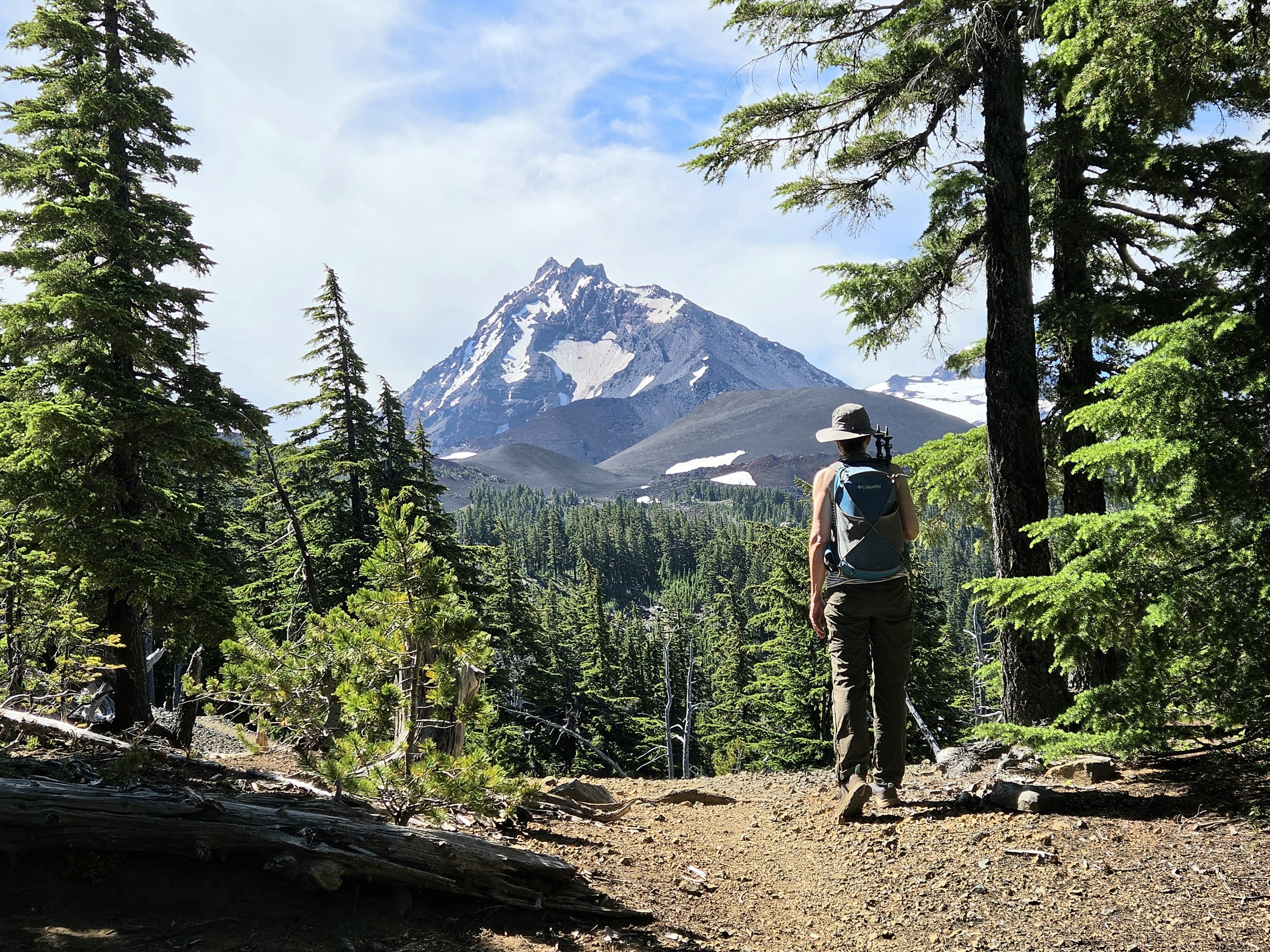

    The return hike offers changing light and fresh perspectives of North Sister.


    Why This Hike Stands Apart

    Central Oregon offers no shortage of spectacular trails. But few combine so many distinct landscapes into a single day. In one hike you'll experience:

    • Ancient forests
    • Alpine lakes
    • Wildflower meadows
    • Massive lava flows
    • A towering cinder cone
    • Expansive Cascade viewpoints
    • Glacial terrain
    • North Sister up close

    Rather than feeling like one destination, this trail unfolds as a series of unforgettable chapters—each one completely different from the last. For hikers looking for one of the most diverse adventures in the Central Cascades, the journey from Lava Camp to Collier Glacier is difficult to beat.


    Hiking Stats

    Trail Lava Camp to Collier Glacier
    Location McKenzie Pass Scenic Highway (OR Hwy 242)
    Distance 14.63 miles round trip
    Elevation Gain 2,236 feet
    Difficulty Difficult
    Trail Type Out-and-back
    Season Mid-July through early October
    Permits Central Cascades Wilderness Permit required during quota season
    June
    3

    Hiking the Paulina Lake Loop: Hot Springs, Volcanic Views, and One of Central Oregon's Best Lake Trails

    There are some hikes in Central Oregon that leave a lasting impression, and the loop around Paulina Lake is one of them.

    Yesterday, we completed the 7-mile hike around Paulina Lake within the spectacular Newberry National Volcanic Monument. With only 207 feet of elevation gain, the trail is relatively easy by Central Oregon standards, but what it lacks in climbing it more than makes up for in scenery, geology, and unique features that simply don't exist anywhere else in the region.

    Paulina Lake Paulina Lake

    A Lake Inside a Volcano

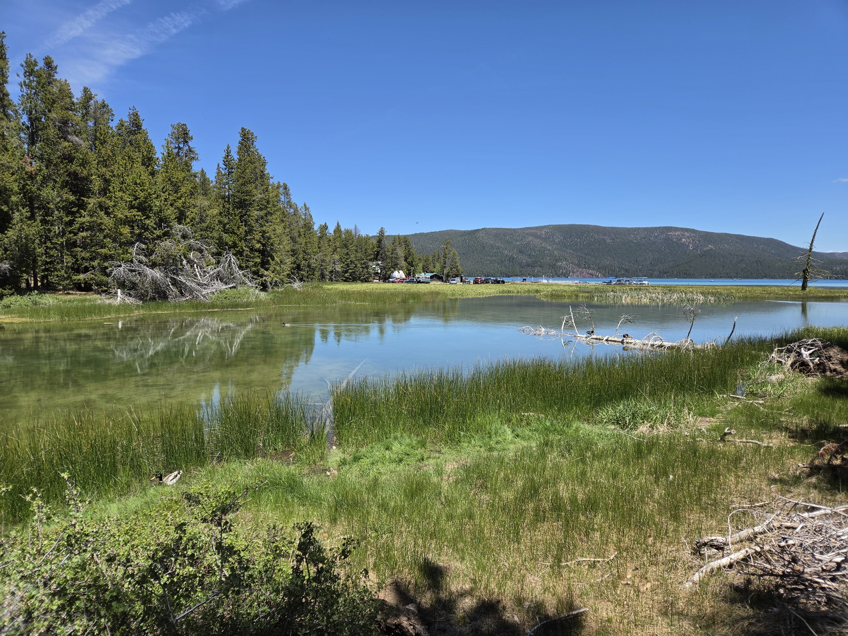
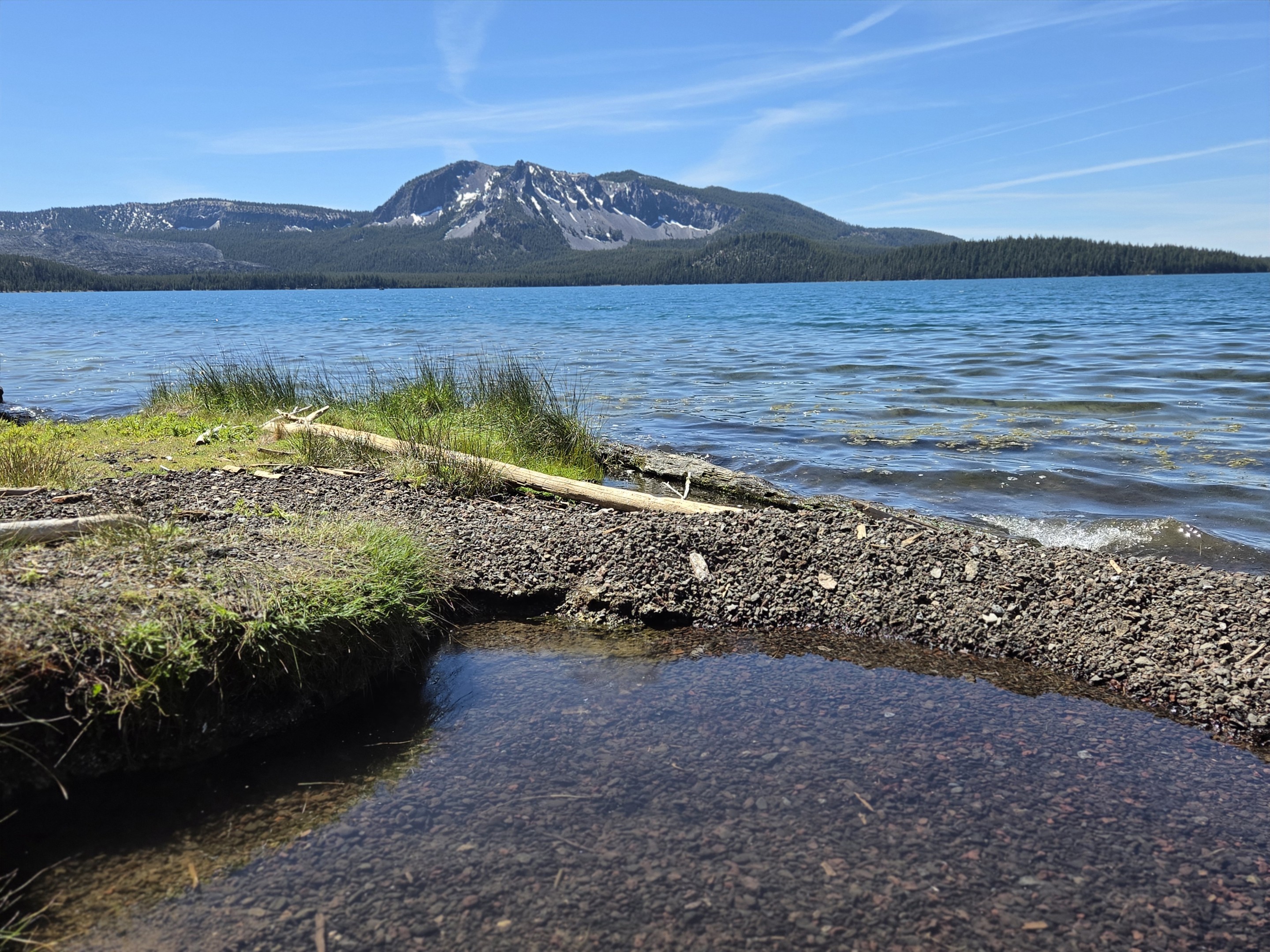
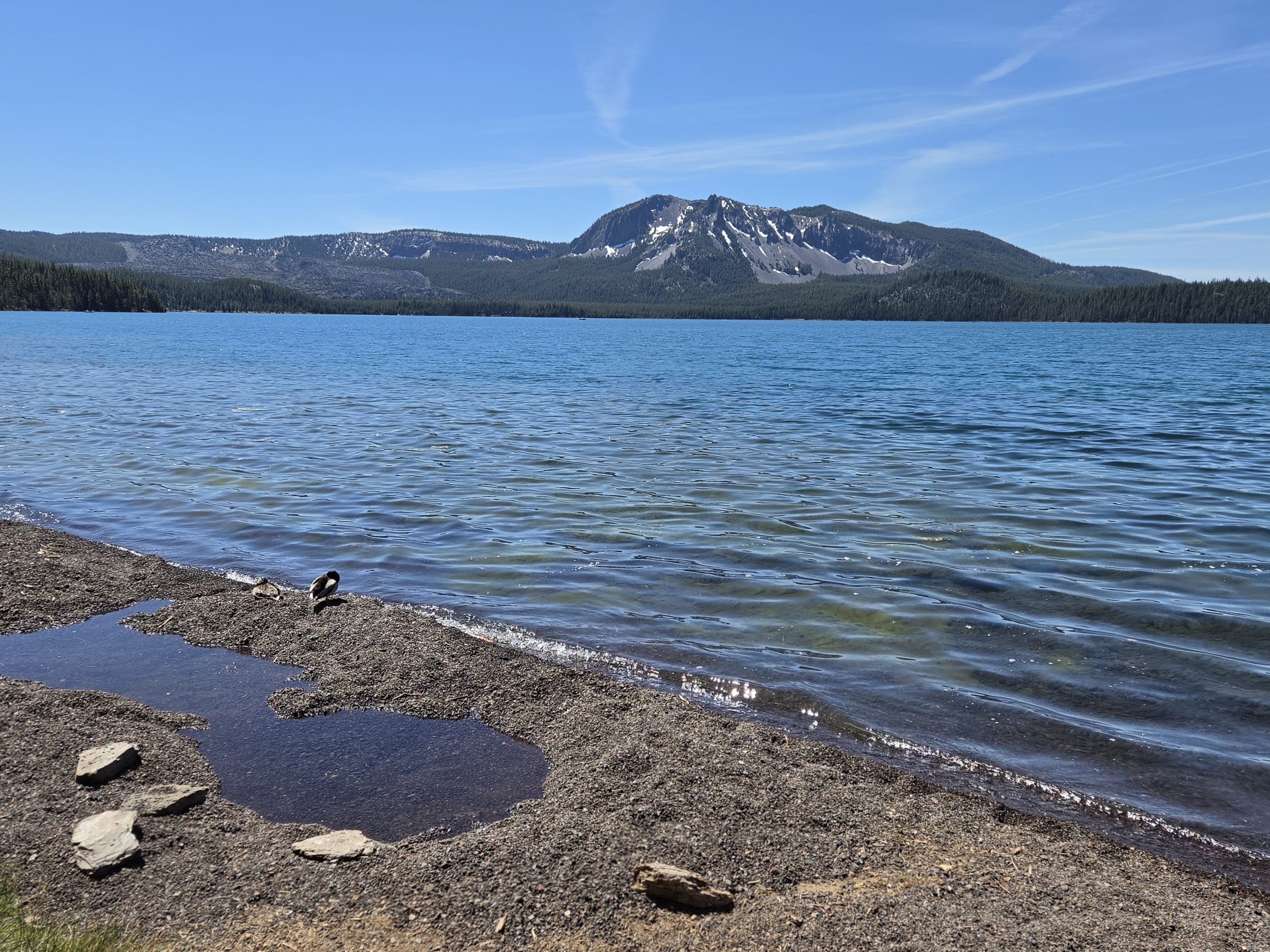
    Paulina Lake sits within the massive caldera of Newberry Volcano, one of the largest volcanoes in the Cascade Range. The caldera itself is nearly five miles across and contains both Paulina Lake and nearby East Lake. The volcanic landscape surrounding the lake is the result of thousands of years of eruptions, lava flows, obsidian deposits, and geothermal activity that continues today. As we started the hike, the towering cliffs of Paulina Peak and the rugged volcanic ridges dominating the skyline immediately drew our attention. Even on a sunny summer day, patches of snow remained tucked into the steep gullies above the lake. One of the most impressive aspects of this trail is that the scenery changes constantly. The route moves through lodgepole pine forests, open shorelines, marshy wetlands, lava formations, and quiet coves with crystal-clear water.

    The Trail Around the Lake

    The Paulina Lakeshore Trail follows the shoreline for nearly the entire route, offering continuous views across the deep blue water. Paulina Lake itself covers more than 1,500 acres and reaches depths of approximately 250 feet. It is fed primarily by snowmelt, groundwater seepage, and geothermal springs. Because the trail stays close to the water, the elevation gain remains modest. The path gently rolls through the forest, occasionally climbing above the shoreline before descending back toward the lake.

    Along the way we encountered:

    • Expansive views of Paulina Peak
    • Volcanic cliffs and lava formations
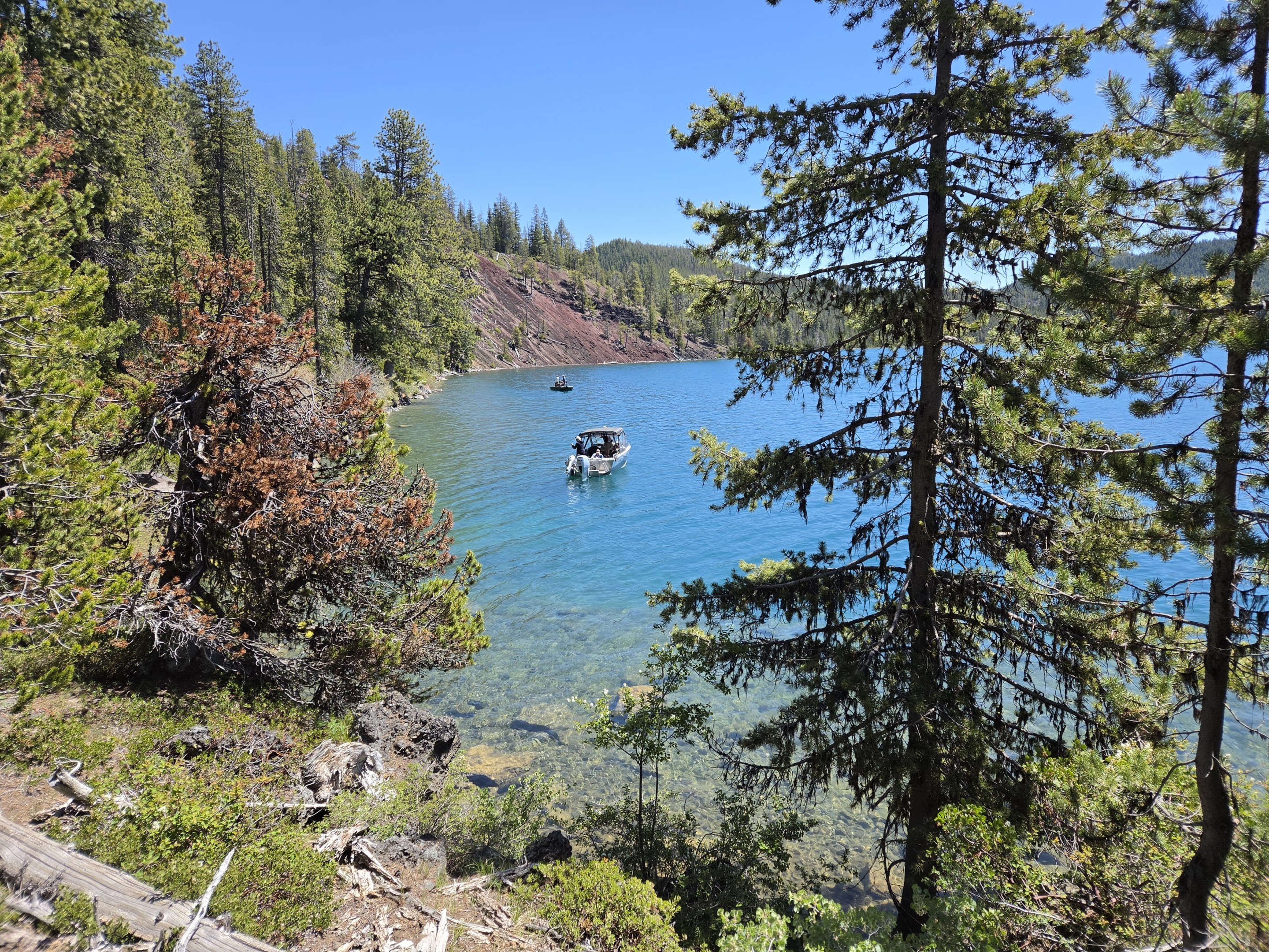
    • Clear, shallow coves with turquoise water
    • Wetland areas filled with birdlife
    • Numerous fishing boats taking advantage of the lake's renowned trout fishery
    • Quiet forest sections where the sounds of the water replaced everything else

    The diversity packed into seven miles is remarkable.

    The Famous Hot Springs

    For many visitors, the highlight of the hike is reaching the hot springs located along the north shore of the lake. Unlike developed hot springs with constructed pools, the Paulina Lake Hot Springs remain largely natural. Hot geothermal water bubbles up beneath the shoreline and mixes with the cool lake water. Visitors often dig shallow pits in the sand to create their own temporary soaking pools. By adjusting the depth and location, people can customize the water temperature to their liking. Watching steam rise from the shoreline while standing beside a cold mountain lake is a reminder that the volcanic forces that created Newberry are still very much present beneath the surface. The hot springs can be reached via a short hike from Little Crater Campground, but hiking the entire lake loop provides a much richer experience and allows visitors to see far more of the caldera.

    Paulina Lake

    More Than Just a Hike

    One of the things that makes Paulina Lake special is how many different recreational opportunities exist in one location.

    Visitors can:

    • Hike the lakeshore trail
    • Fish for trophy trout and kokanee salmon
    • Kayak or paddleboard
    • Boat on the lake
    • Soak in natural hot springs
    • Explore the nearby Big Obsidian Flow
    • Visit Paulina Falls
    • Drive to Paulina Peak for panoramic views of Central Oregon

    All of these activities exist within the same volcanic caldera.

    A Photographer's Dream

    The conditions yesterday were nearly perfect. The deep blue water reflected the clear Central Oregon sky, while the volcanic ridges provided dramatic contrast against the surrounding forests. The shoreline wetlands added another layer of visual interest, especially where the clear spring-fed water met the lake. Several of the best views came from elevated sections of trail overlooking the lake, where the turquoise water and dark volcanic slopes created scenes that looked more like the Canadian Rockies than Central Oregon.

    Final Thoughts

    For hikers looking for an approachable day hike with exceptional scenery, the Paulina Lake Loop deserves a place near the top of the list. At 7 miles with minimal elevation gain, it is accessible to most hikers. Yet the experience feels much larger than the mileage suggests. Between the volcanic history, pristine lake views, geothermal hot springs, abundant wildlife, and ever-changing landscapes, there is rarely a dull moment on the trail.

    Central Oregon is known for its mountains, rivers, and high desert terrain, but Paulina Lake offers something different—a chance to walk the shoreline of a volcano while soaking in views that remind you just how unique this region truly is.

    Trail Stats

    • Distance: Approximately 7 miles
    • Elevation Gain: 207 feet
    • Difficulty: Easy to Moderate
    • Location: Paulina Lake, Newberry National Volcanic Monument
    • Best Season: Late spring through fall
    • Highlights: Hot springs, volcanic scenery, lake views, fishing, wildlife, and geothermal features

    For anyone who has not yet explored Paulina Lake, it is one of the most rewarding and unique hikes within an hour of Bend.

    May
    6

    What is in the May 2026 Bend Premier Newsletter?

    • Prices Pull Back WHile Buyer Activity Holds Steady
    • Spring Herb ChickenSalad Croissants
    • Small Kitchen Improvements With Big Impact
    • The Historic Black Butte Hike Can Be Challenging
    • How To Make Your Offer Stand Out This Spring

    Older Posts ⇨
    Disclaimer: All information deemed reliable but not guaranteed. All properties are subject to prior sale, change or withdrawal. Neither listing broker(s) or information provider(s) shall be responsible for any typographical errors, misinformation, misprints and shall be held totally harmless. Listing(s) information is provided for consumers personal, non-commercial use and may not be used for any purpose other than to identify prospective properties consumers may be interested in purchasing. Information on this site was last updated 08/01/2026. The listing information on this page last changed on 08/01/2026. The data relating to real estate for sale on this website comes in part from the Internet Data Exchange program of Delta Media Group MLS (last updated Sat 08/01/2026 4:13:03 PM EST) or RMLS (last updated Fri 07/31/2026 2:43:17 AM EST) or COAR/MLSCO (last updated Sat 08/01/2026 4:11:48 PM EST). Real estate listings held by brokerage firms other than Bend Premier Real Estate may be marked with the Internet Data Exchange logo and detailed information about those properties will include the name of the listing broker(s) when required by the MLS. All rights reserved.
    Privacy Policy / DMCA Notice / ADA Accessibility

    Login to My Homefinder

    Pixel