

Subscribe and receive email notifications of new blog posts.
 RSS Feed
25
A Clear September Day Above No Name Lake—and a Climber on Broken Top
We have hiked from Three Creek Lake past Tam McArthur Rim toward Broken Top and No Name Lake several times, but the same trail is never quite the same hike. Weather, snow, smoke and trail conditions can completely change the experience. On September 22, 2026, remarkably clear skies gave us some of the longest views we have ever had from this route—and, for the first time, we watched a climber reach the summit of Broken Top.
Our route also differed from previous trips. We followed the maintained trail to Tam McArthur Rim, continued on the well-defined but unmaintained trail toward Broken Hand, and then took a much fainter path around the formation to meet the primary route to No Name Lake. After visiting the lake, the high overlook and our favorite lunch spot, we returned around the opposite side of Broken Hand.
By the time we reached the car, we had traveled 11.71 miles and climbed approximately 2,200 feet.
Climbing Above Three Creek Lake
The hike begins at the Tam McArthur Rim Trailhead near Three Creek Lake outside Sisters. The maintained trail climbs steadily through forest before opening to increasingly broad views over the lake and the surrounding Central Oregon landscape.
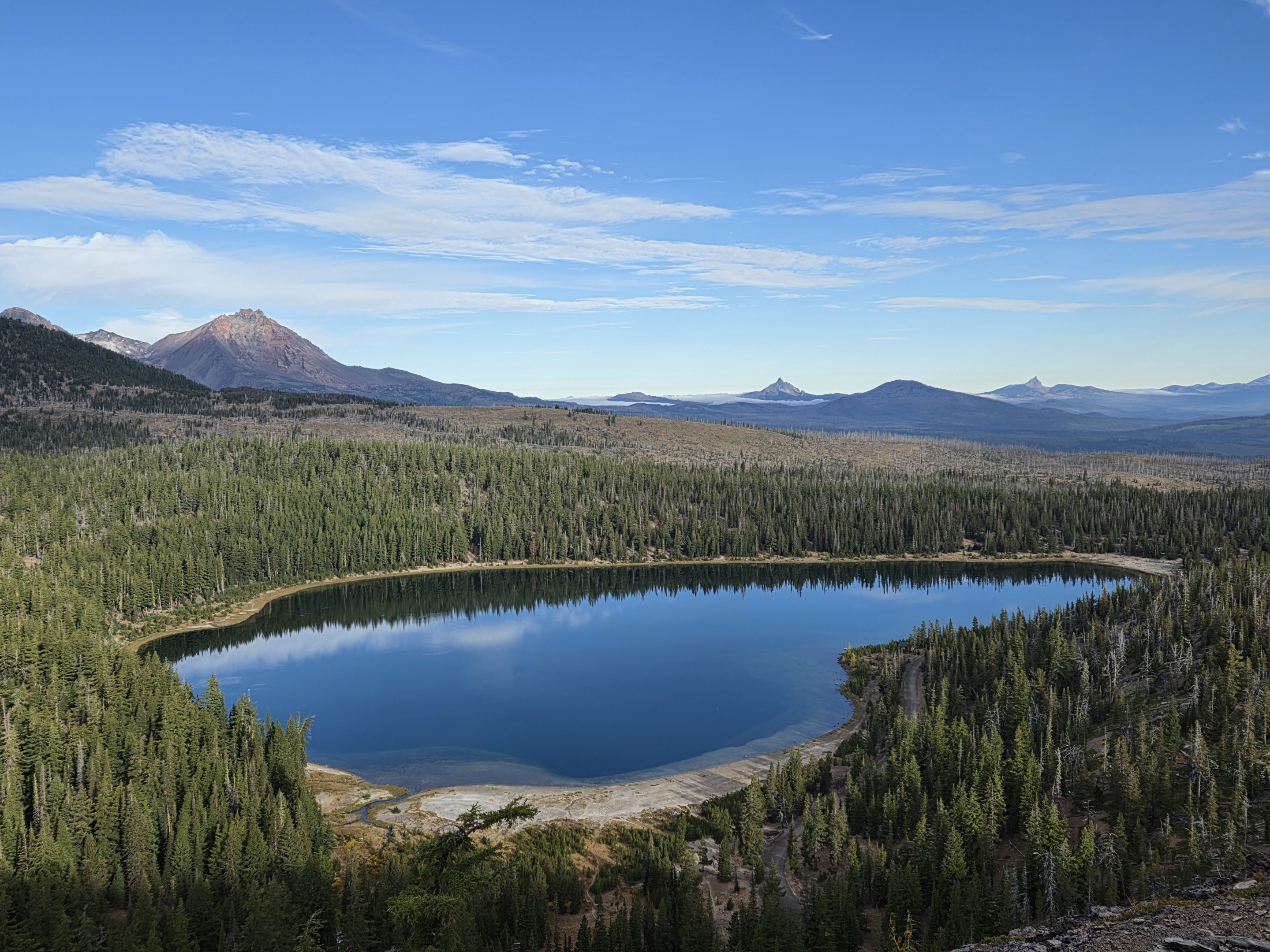
Tam McArthur Rim is a rewarding destination on its own, but the country beyond the rim becomes rougher, quieter and far more dramatic. The maintained trail ends, yet a well-defined user trail continues across open volcanic terrain toward Broken Top and Broken Hand.
Unlike our smoky summer hike in 2024 or the windy fall conditions we encountered later that year, this September day offered unusually clear visibility. Broken Top and the Three Sisters stood out sharply, and distant Cascade peaks remained visible for much of the day.
Taking the Faint Trail Around Broken Hand
As we approached Broken Hand, we reached a split in the trail. Instead of continuing on our more familiar route, we followed a faint unmaintained path around the formation. Although the path could be followed, it was far less obvious than the main unmaintained trail from Tam McArthur Rim.
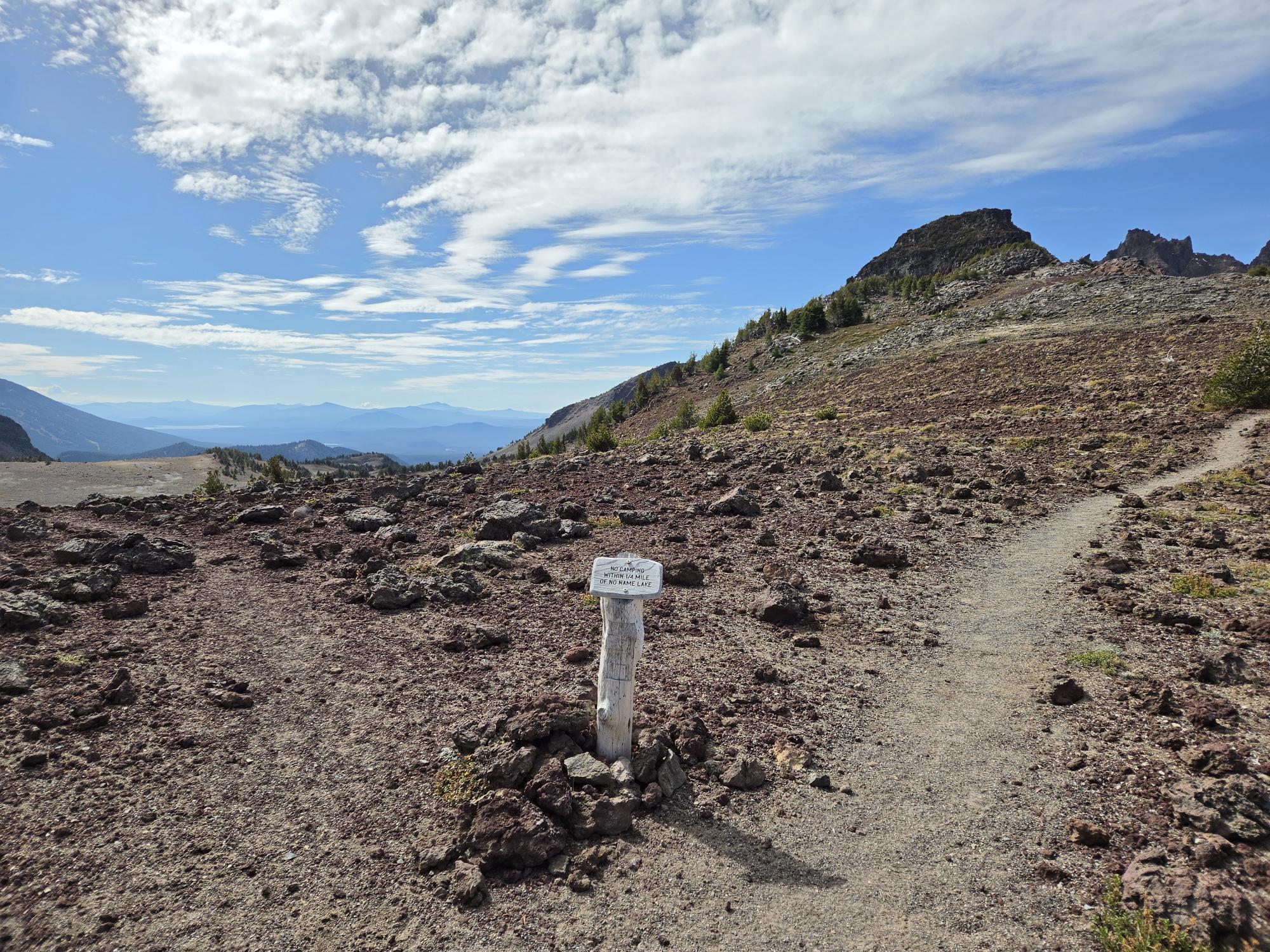
This section required more route awareness as we worked our way around Broken Hand and eventually joined the more established path used by hikers approaching No Name Lake from the other direction. From there, we continued upward toward the lake beneath the colorful, broken cliffs of Broken Top.
This is rugged alpine terrain rather than a conventional maintained hike. The volcanic soil can be loose, the trail can fade, and the weather can change quickly. Anyone continuing beyond Tam McArthur Rim should be comfortable navigating an unmaintained route and prepared to turn around if conditions become questionable.
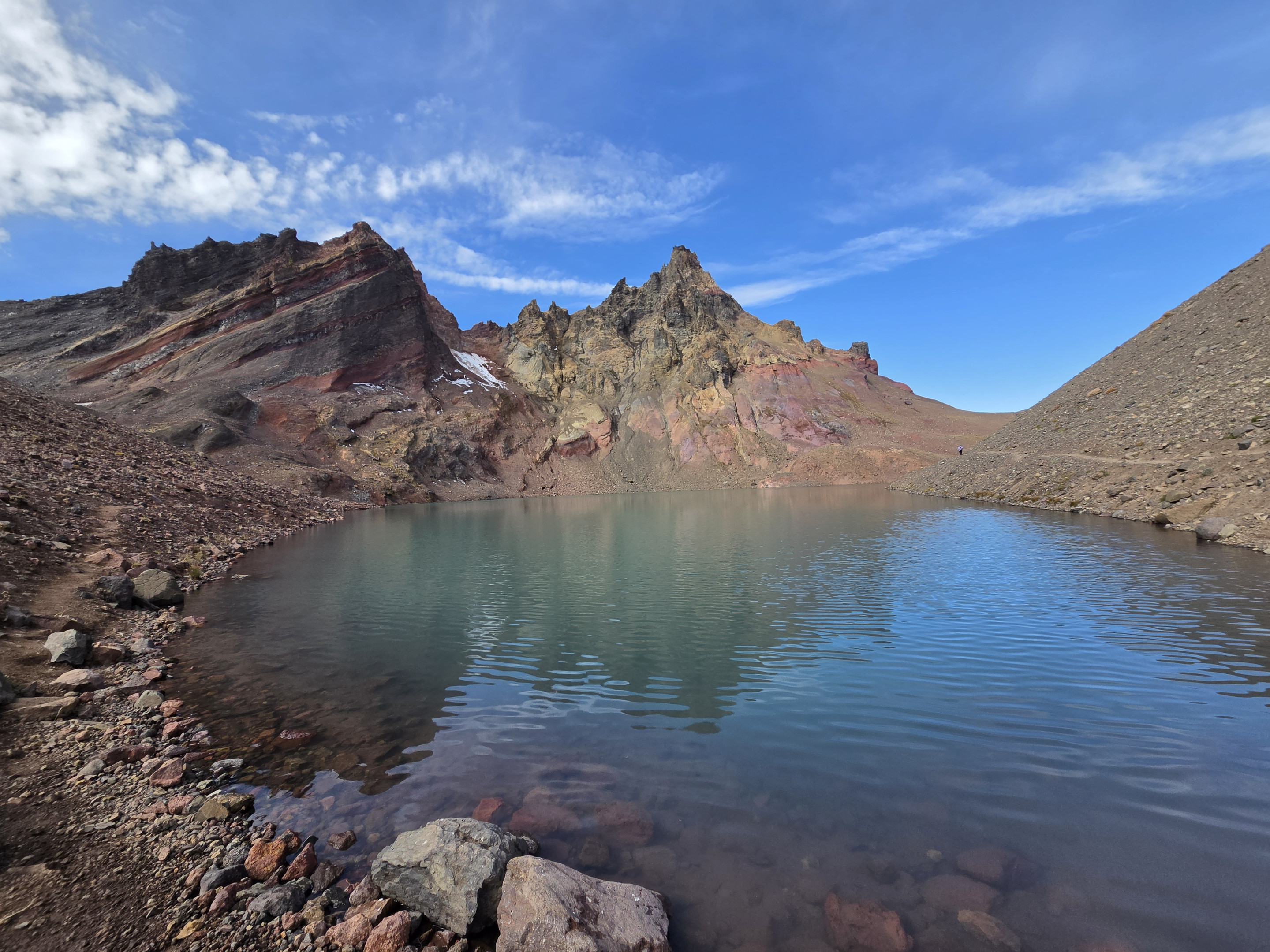
No Name Lake Beneath Broken Top
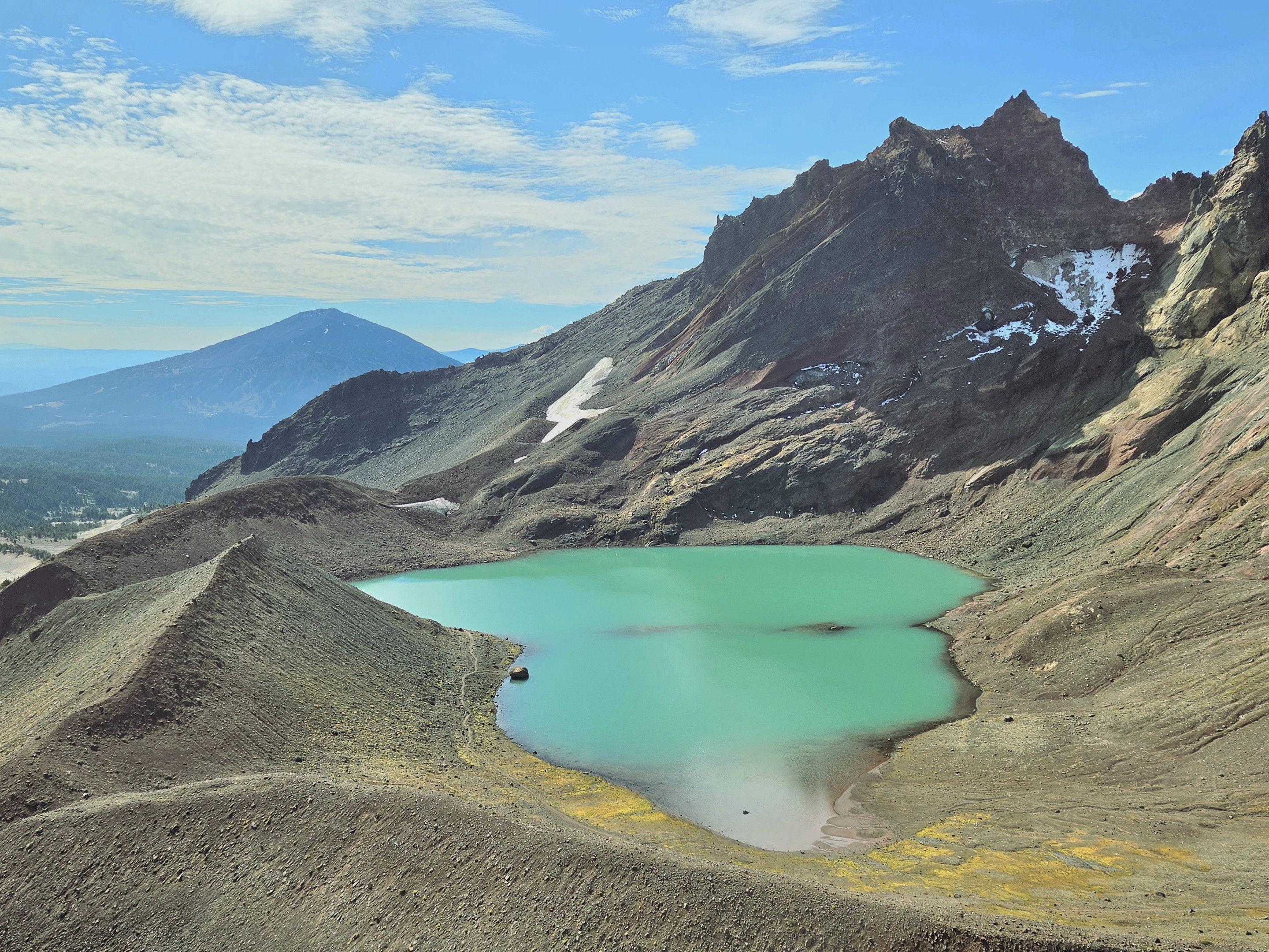
No Name Lake was as striking as ever. Its turquoise water sat beneath the red, gold and gray rock of Broken Top, with the mountain's jagged summit rising directly above it. Even after visiting several times, the first view of the lake still makes us stop.
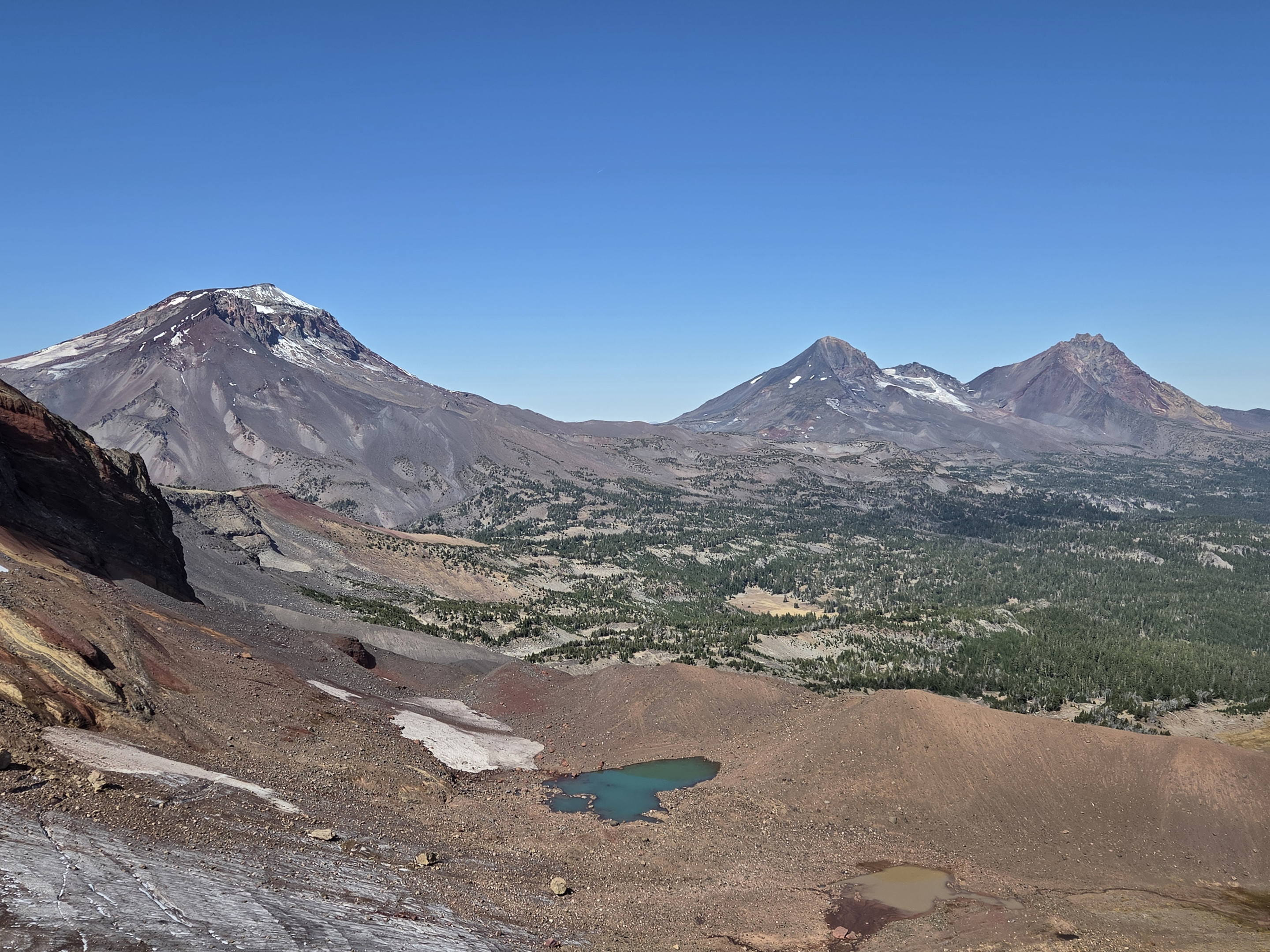
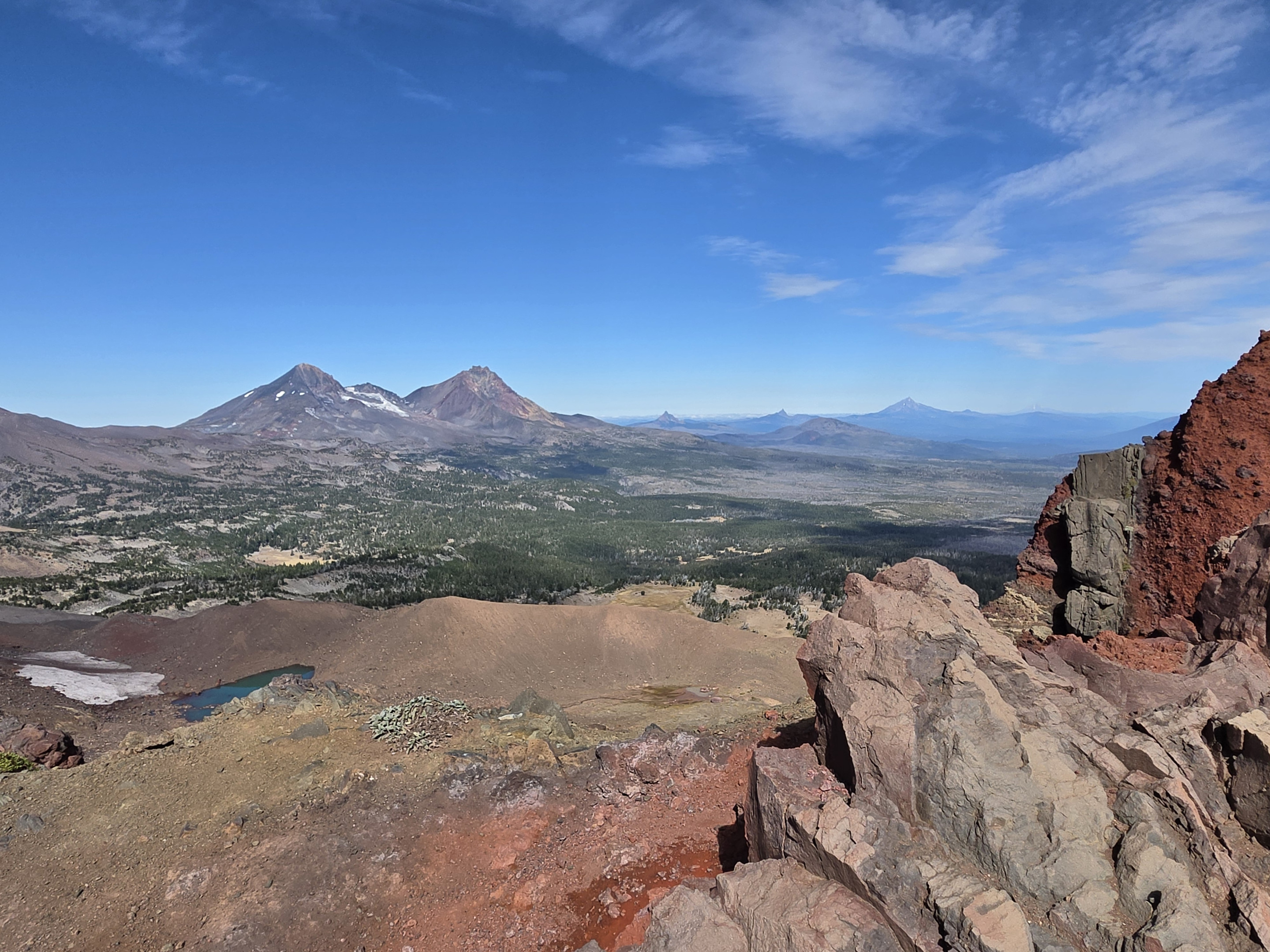
From the lake, we climbed higher to the overlook. The additional effort is well worth it because the view expands far beyond Broken Top. On this exceptionally clear day, we could see the Three Sisters, Mount Washington, Three Fingered Jack, Mount Jefferson, Mount Hood and even Mount Adams in the distance.
Closer to us was the small glacial lake beside what remains of Bend Glacier on the flank of Broken Top. Seen from above, the bright water, dark moraine and scattered remnants of snow and ice showed just how much this landscape has been shaped by glaciers.
Watching a Climber Summit Broken Top
We then continued to our favorite lunch spot overlooking No Name Lake. From this location, the lake appears almost directly below, framed by the steep inner walls of Broken Top. Mount Bachelor and Ball Butte rise beyond the basin, creating one of the most memorable lunch views in Central Oregon.
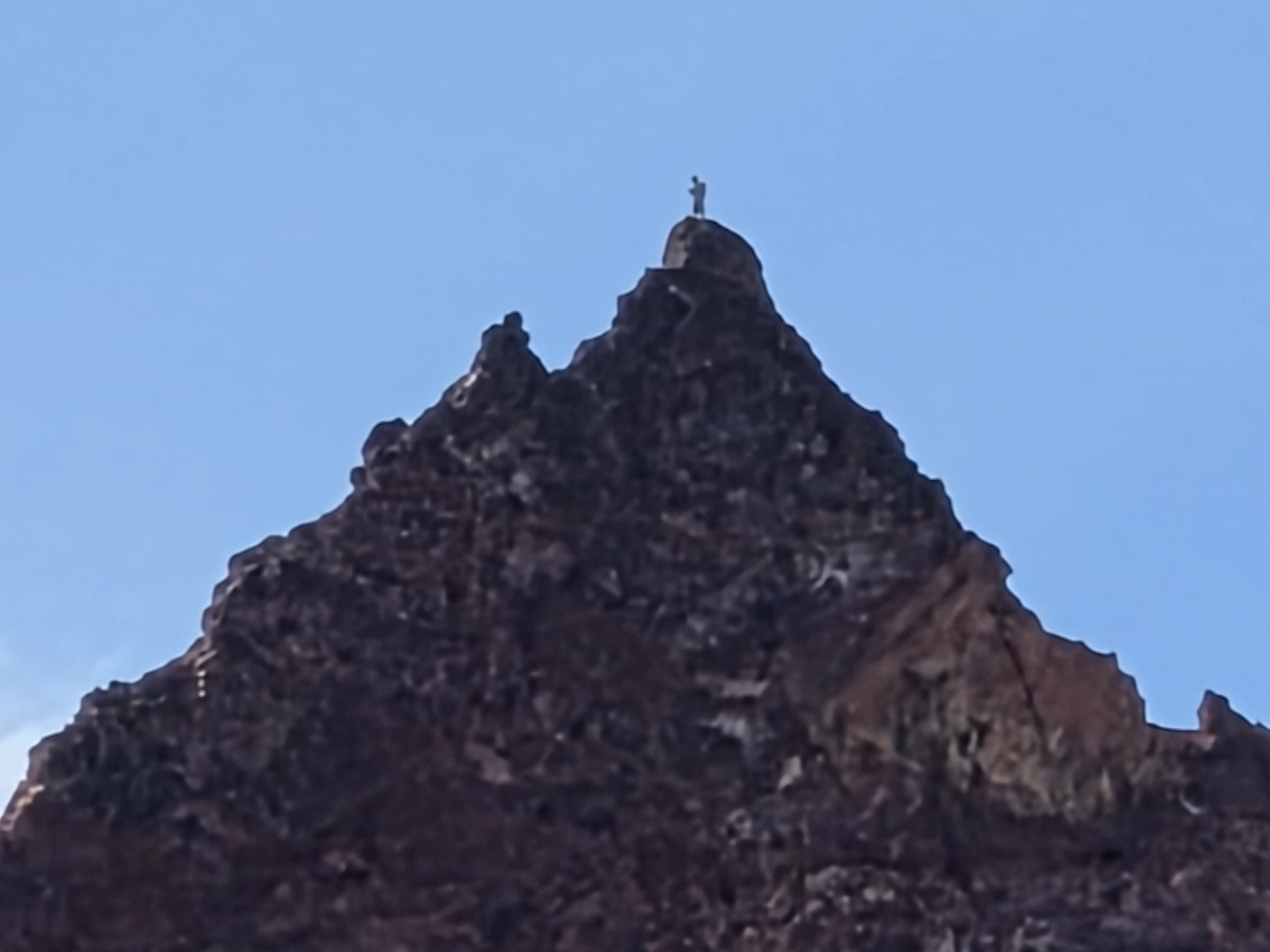
While we were there, I noticed movement high on the summit ridge. At first, the climber was only a tiny shape against the rock. We watched as the person continued upward and eventually stood on the summit of Broken Top.
We have hiked beneath this mountain many times, but we had never before seen anyone actually reach the top. Broken Top's summit is a technical climb rather than an extension of the hiking trail, and watching someone stand on that exposed pinnacle put the scale and steepness of the mountain into perspective.
Returning on the Other Side of Broken Hand
After lunch, we descended to the main route and returned around the opposite side of Broken Hand, completing a partial loop through the high alpine terrain. The return gave us another perspective on the formation and eventually rejoined the familiar trail across Tam McArthur Rim.
Our final distance was 11.71 miles with approximately 2,200 feet of elevation gain. Those numbers do not fully describe the difficulty. The unmaintained sections, faint path around Broken Hand, loose volcanic footing and exposure make the hike more demanding than an ordinary trail of similar length.
This was not our first hike to No Name Lake, but the clear skies, alternate route and sight of a climber standing on Broken Top made it an entirely new experience. That is one reason we keep returning to this part of the Cascades: even on familiar ground, there is nearly always something we have never seen before.
Related Broken Top and No Name Lake Hikes
Our earlier trips show how dramatically the same destination can change with the route, season and weather:
Privacy Policy / DMCA Notice / ADA Accessibility


