

All Things Central Oregon
 RSS Feed
Subscribe and receive email notifications of new blog posts.
RSS Feed
Bend Makes Another List | 3 Posts
Bend Oregon Real Estate Trends | 65 Posts
Bend Premier Real Estate Listings | 2 Posts
Bend Premier Real Estate News | 25 Posts
Bend Real Estate General Information | 134 Posts
Bend's Best Bites | 1 Posts
Central Oregon Real Estate | 23 Posts
Central Oregon Real Estate Market Trends | 9 Posts
Fun Real Estate Facts | 1 Posts
Great Oregon Hikes | 61 Posts
Happenings in Bend | 7 Posts
Luxury Real Estate | 15 Posts
Neighborhoods to See in Bend Oregon | 10 Posts
Newsletters | 36 Posts
Places to See in Central Oregon | 21 Posts
Redmond Oregon Real Estate Trends | 7 Posts
Uncategorized | 6 Posts
Why We Love Central Oregon | 19 Posts
July
17
17
Marion Mountain Hike has Lakes, Mountains and Waterfalls
Marion Mountain Hike has it All in Central Oregon
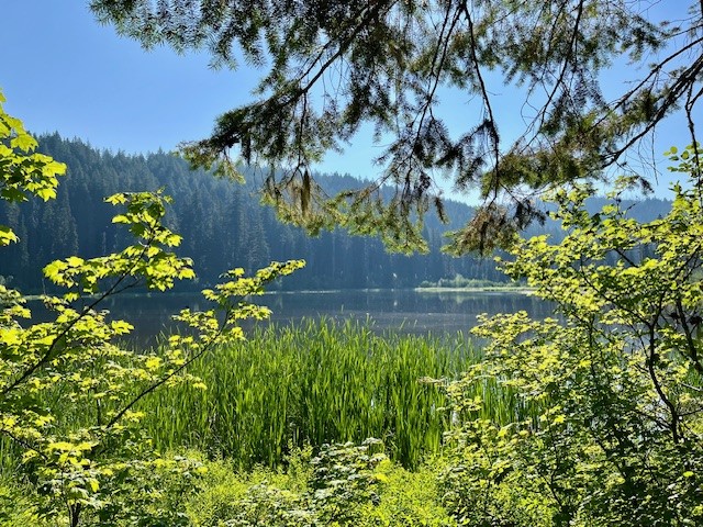
Past Santiam Pass off Hwy 22 over the bridge at Marion Forks is the turn off to the trail head for Marion Lake/Mountain. Hikers have to travel over 5 miles down a paved, then decent gravel road to the trail head and must present a forest pass to hike the trail. Once past the trail head, hikers climb two miles through old growth forest until they reach Lake Ann, accessing the lake shore over a stone covered creek which flows from the lake. The trail skirts the end of Lake Ann and after a half a mile, reaches Marion Lake.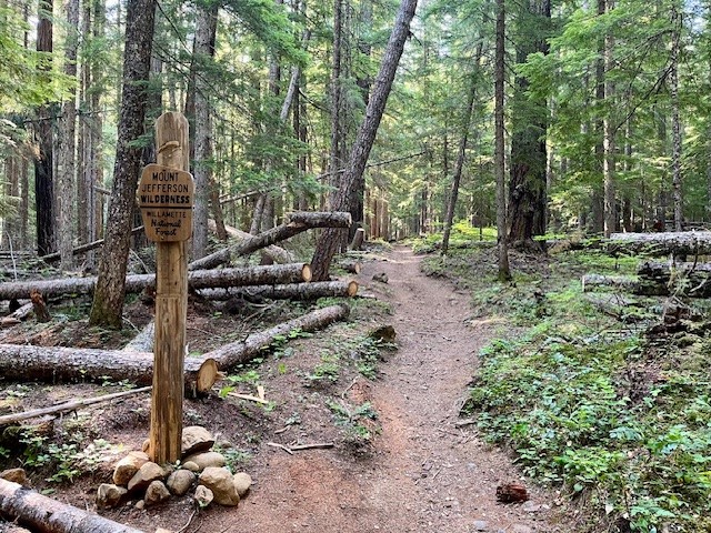 |
 |
 |
 |
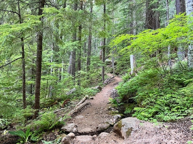
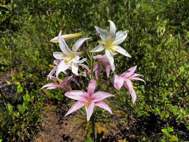
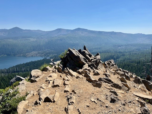
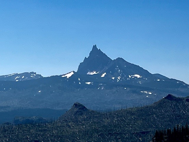
The trail splits here. Hikers wishing to take the path next to Marion Lake can do so, and others wishing to bypass the lake and travel on to either Marion Falls or Marion Mountain can do that. The path to Marion Mountain connects again with the path next to the lake, but past the lake the path steepens as hikers gain elevation hiking up Marion Mountain. There are scattered open areas (complete with the remnants of forest fires) and forested areas as the remaining miles to the top of the mountain are climbed. At the top of the mountain the views of Mt Jefferson and Three Fingered Jack are wonderful. The viewpoint is on a narrow rocky outcrop with steep drop-offs on each side. On July 13, 2024, butterflies and summer wildflowers were abundant.
 |
 |
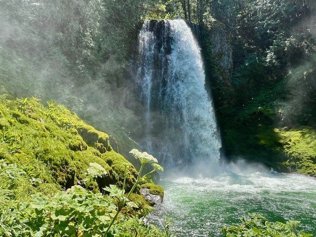
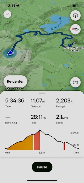
On the hike back to the trail head, an unmarked path near the Marion Lake junction leads to Marion Falls. Hikers to the falls have to traverse over and around downed trees and a very steep path to get to Marion Falls. However, seeing the falls up close is wonderful. There is another steeper path to access the lower falls which adventurous hikers can take. The negative of seeing the falls up close is the steep path - which has to be climbed to get out and back to the main path back to the trail head. All in all, the total distance traveled was over 11 miles with over 2200 feet of elevation gain.
 |
 |
Privacy Policy / DMCA Notice / ADA Accessibility
This site is hosted, designed and copyright
© 1994 - 2026 by
Delta Media Group, Inc. -- Patent Pending --