

Posts with tag 'Sisters'
Subscribe and receive email notifications of new blog posts.
 RSS Feed
4
Take the Climbers Trail to Middle Sister and See Sights Few Experience
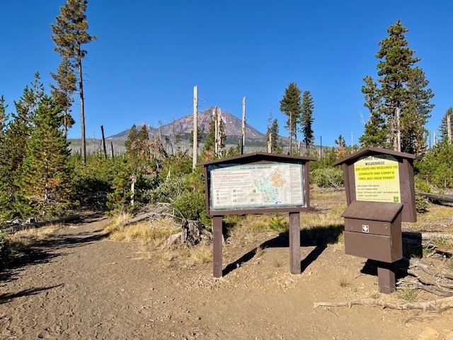
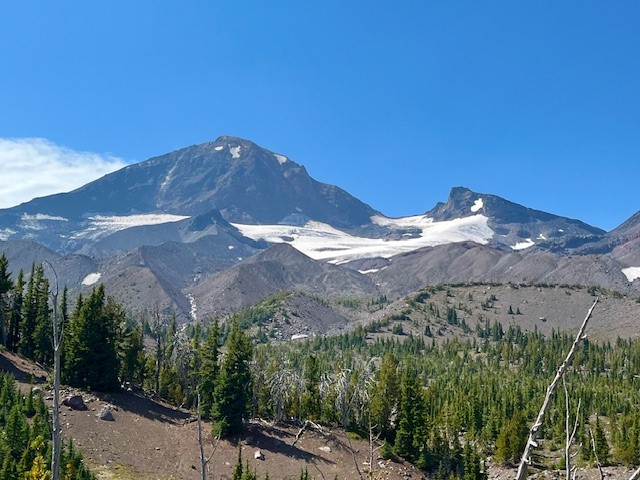
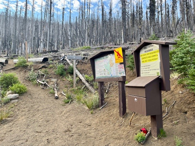
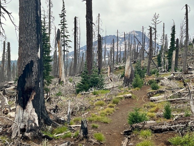
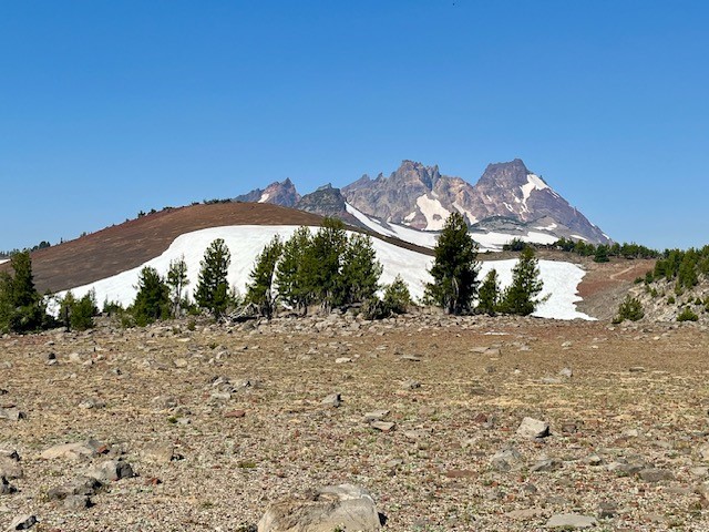
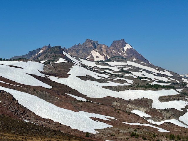
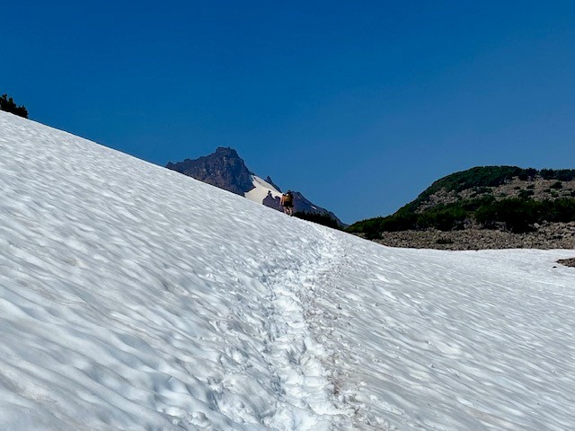
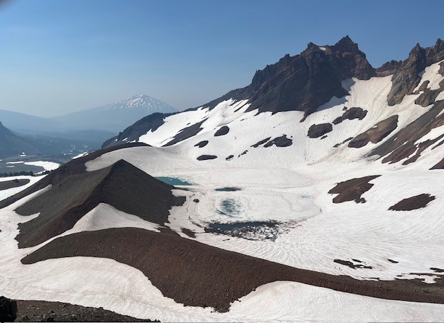
If you are one of the people who love to climb mountains, you are probably familiar with the climber's trail which provides the established way to summit North Sister in the Oregon Cascades. For those not that ambitious but who love a long day hike, taking the trail part way will enable hikers to have amazing Cascades views plus close up access to Hayden Glacier on Middle Sister.
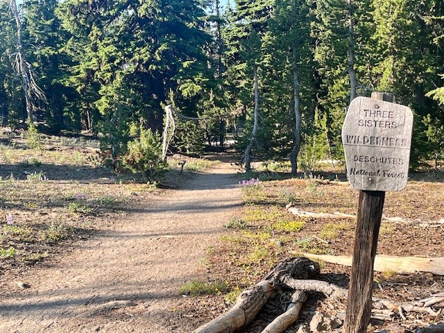
The route to Hayden Glacier starts at the Pole Creek Trailhead. This is the same trail that is taken to reach Camp Lake which provides for wonderful access to the north facing slopes of South Sister. The first 3.5 miles is through the burned forest of the 2012 Pole Creek fire, but after leaving burned woods, the trail enters healthy forest and the trek is shaded. Before hikers reach the North Fork of Whychus Creek, an unmarked trail intersects the main path. Climbers take this path (which has an optional loop up and back) to access the hike to summit North Sister.
 |
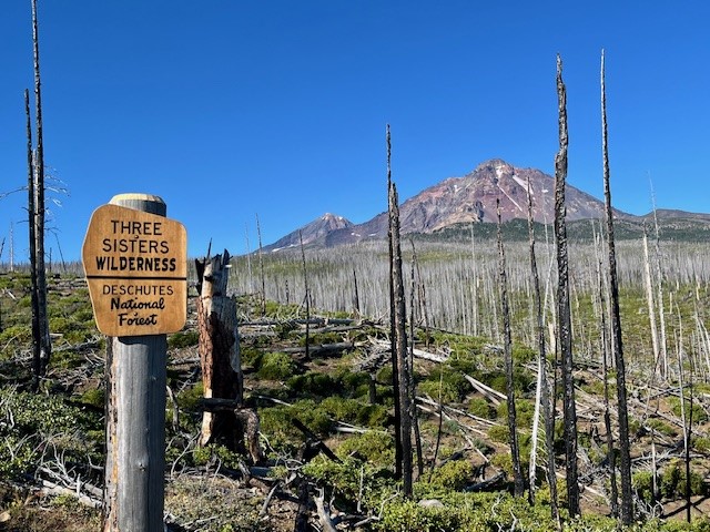 |
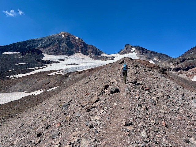
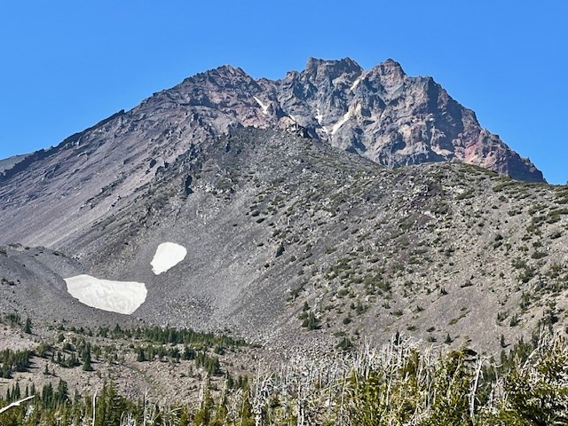
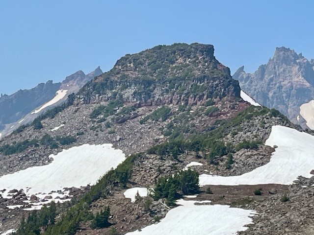
The climbers' trail gains elevation quickly as hikers walk up the lower slopes of Middle and North Sister. The first mile or so remains in shaded forest, but as hikers gain elevation, they leave forest and start walking through the jumbled rock and ash of multiple moraines. At one time these were filled with glaciers, but these have mostly melted, leaving behind the steep gullies and loose stone scrapped off the mountains over thousands of years. Climbing up the moraines can be difficult, but coming down is harder as it is easy to slip on the loose stone.
 |
 |
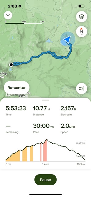
For those who do continue the technical climb up North Sister, it is recommended this be done in a group with people who really know what they are doing. For those of us who just enjoy a great, long day hike, the option to travel to Hayden Glacier is one very few do and it can be very rewarding. The entire trip, including the loop up and back the climber's trail, is under 3000 feet of elevation gain and less than 13 miles back to the Pole Creek Trailhead.
21
Golden Lake is a Hidden Treasure in the Three Sisters Wilderness
Golden Lake is Not an Easy Hike
For Central Oregon residents and visitors looking for a great day hike, there are a good number of options available. For many, a hike of 2 to 4 miles to an amazing destination followed by the same distance back can create a full day with time to relax and enjoy both the original destination and the time back home. However, for those wishing to see more in the Cascade forests besides what is seen in a day hike, many will backpack and spend more time enjoying the destination before venturing further or coming back.
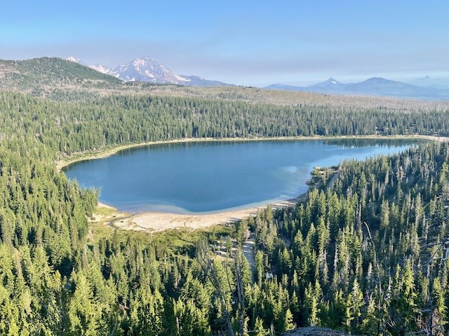
Golden Lake is one of those rarely seen destinations. It can be accessed through multiple approaches. These include the popular Green Lakes Trail in which hikers walk past the northern most Green Lake and travel above the valley to the pass between South Sister and Broken Top and then down the path that leads to Park Meadow, making sure they take the unmarked trail off this path and hike the half mile to Golden Lake. Another approach is from Three Creeks Lake, taking the Park Meadow trail and hiking through and past Park Meadow towards Green Lakes and then taking the unmarked trail to Golden Lake. Both approaches are over seven miles one direction, but the approach from Three Creeks Lake is a little shorter.
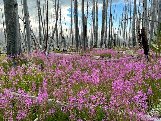
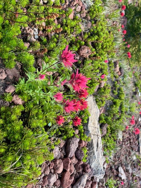
Hikers coming from Three Creeks Lake are required to walk through four miles of burned forest, the result of the Milli Fire seven years ago. There is beauty, however, in the recovering forest with many wildflowers and young trees growing back. Past the burned area, hikers enter forest before they reach Park Meadow, which was untouched by fire and a place many backpackers will spend the night. The trail steepens past park Meadow and after another mile and a half, the turn off to Golden Lake is reached.
 |
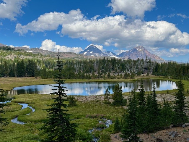 |
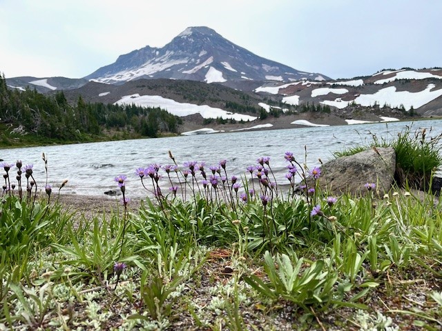
The name for Golden Lake is obvious during certain times of the year when yellow wildflowers are blooming in the meadow that surrounds the lake. The lake itself can reflect Broken Top, South, Middle and North Sisters on calm days. The setting is serene and lovely with very few people around.
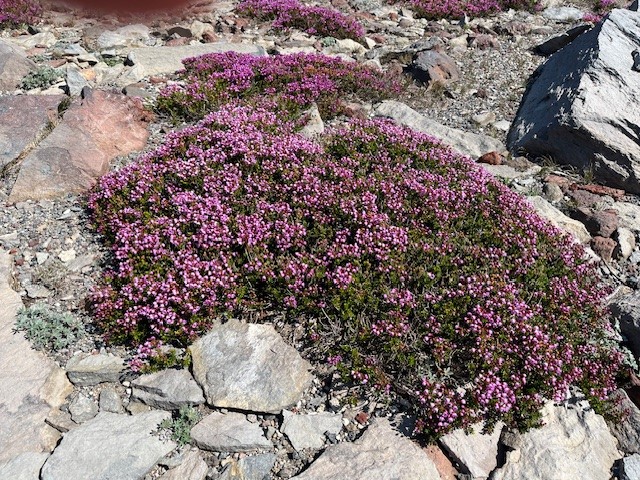
However, one of the most special things about Golden Lake is the small stream which flows into the western side of the lake. Besides the numerous wildflowers growing on each side of the stream, people who take the time to hike the mile up that stream reach an isolated area that very few people ever visit. That last mile is steep, but the cascading stream with its wildflowers and ever changing views of the Three Sisters are amazing. At the end of the stream is a moraine which contains two springs which form the stream. People who scramble up the moraine will reach an isolated tarn lake and past that, another moraine and a second tarn lake even more special than the first. This second lake has phenomenal reflections and views of Broken Top. For those who are able to travel the entire distance, the reward can be some of the most breathtaking natural sights in Central Oregon. It is truly an exceptional place.
For those having enough energy to do the entire hike in a day starting from and returning to Three Creeks Lake, plan on sixteen miles (eight in the burned forest) and over 2000 feet of elevation gain.
 |
 |
14
Black Crater is More About the Destination Than the Journey
Black Crater Trailhead is Located off McKenzie Hwy 242
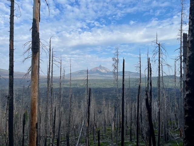
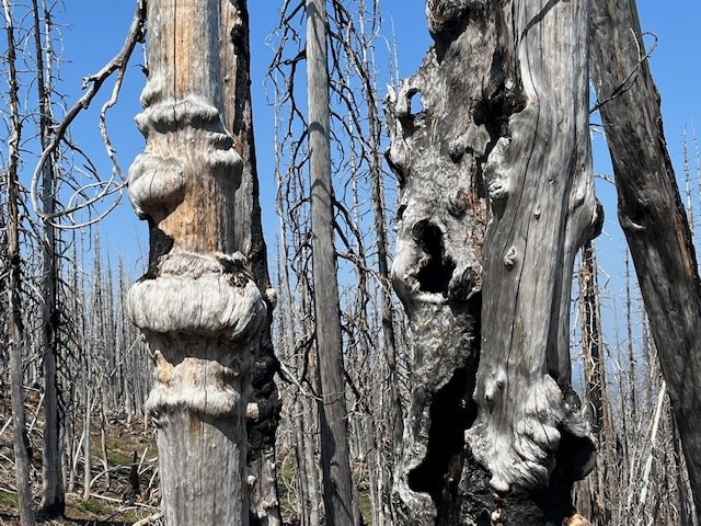
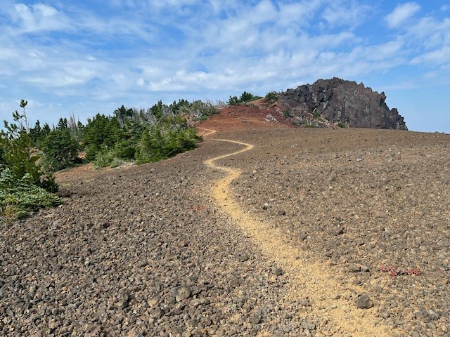
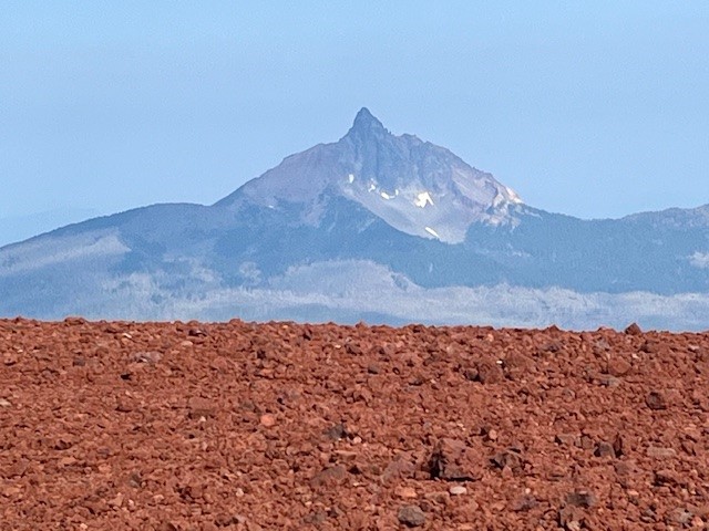
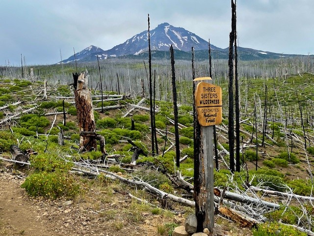
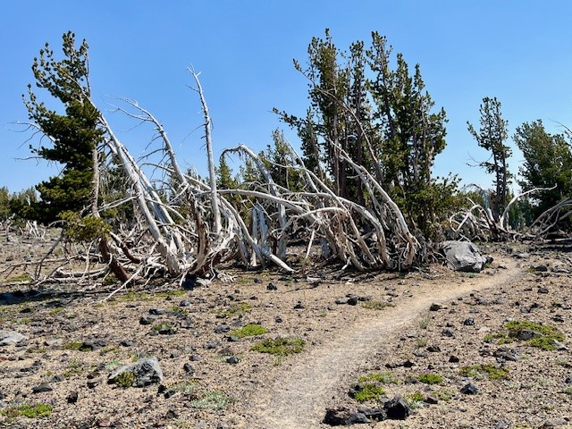
For those wanting a relatively short hike which provides for a lot of elevation gain, Black Crater is one of the best. Located off McKenzie Hwy 242, the hike is limited to the summer season when McKenzie Hwy opens each year. Unfortunately, the 2017 Milli fire burned a lot of the forest on McKenzie Hwy, and the lower slopes of Black Crater were impacted. In the seven years since the Milli fire, manzanita, certain grasses, some wildflowers, and young trees have begun to grow in the dead landscape, but it will take decades until the cinder cone is entirely forested again. The one advantage of the burned forest is the views toward Mt. Washington are far more visible in the lower elevations than they would have been eight years ago.
 |
 |
 |
 |
Roughly two and a half miles into the hike, the burned forest is left and the steep path zigzags through mixed forest and cinder fields. And at three and a half miles, hikers reach the top. The views on a clear day towards The Three Sisters, Broken Top, Mt Jefferson, Mt Washington, and all the hills in McKenzie Pass are fabulous. Plus hikers have the satisfaction of having climbed over 2300 feet to reach the top. The hike down goes faster than the up and many can complete the entire hike, without really pushing, in a little over three hours.
 |
 |
13
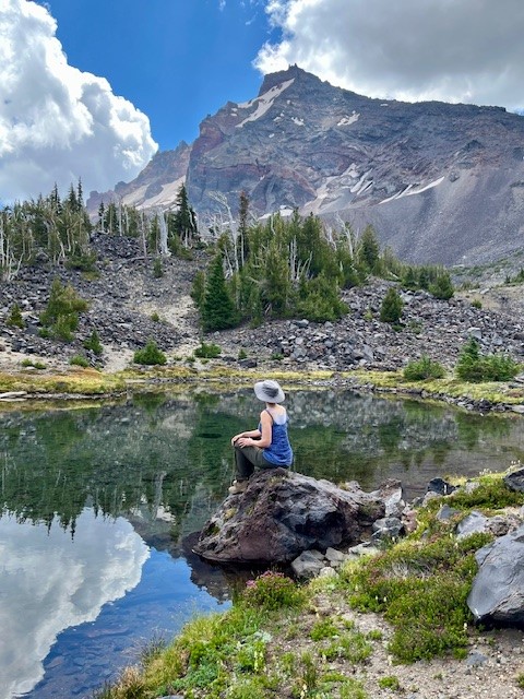
Few Hike to Camp Lake - But it is Worth it!
Camp Lake is at the Base of South Sister
Although many will hike to Green Lakes and enjoy the experience of the lakes in the valley between South Sister and Broken Top, relatively few hike to Camp Lake and see South Sister so close from the north. The hike to Camp Lake (Pole Creek trailhead just outside of Sisters) takes you through several miles of burned forest before hikers enter living forest, so it can be hot and dusty in the summer. However, once hikers reach unburned trees, the hike becomes more pleasant. In recent years, the fallen trees of the burned forest have been cleared from the path, so scrambling over, under and around fallen logs was not an issue in 2024.
On August 3, 2024, the air in Central Oregon was better than it had been earlier in the week (many Oregon forest fires have impacted air quality), so the hike to Camp Lake was relatively clear. Views of North and Middle Sister stood out among the dead forest, but it was also interesting to see the new growth in acres of manzanita, grasses, some wildflowers, and young trees.
 |
 |
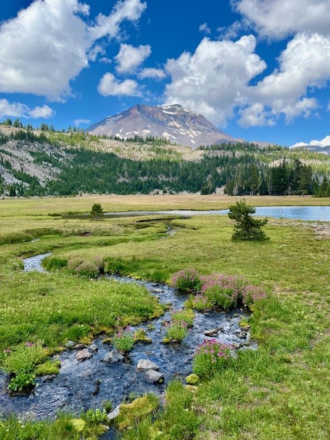
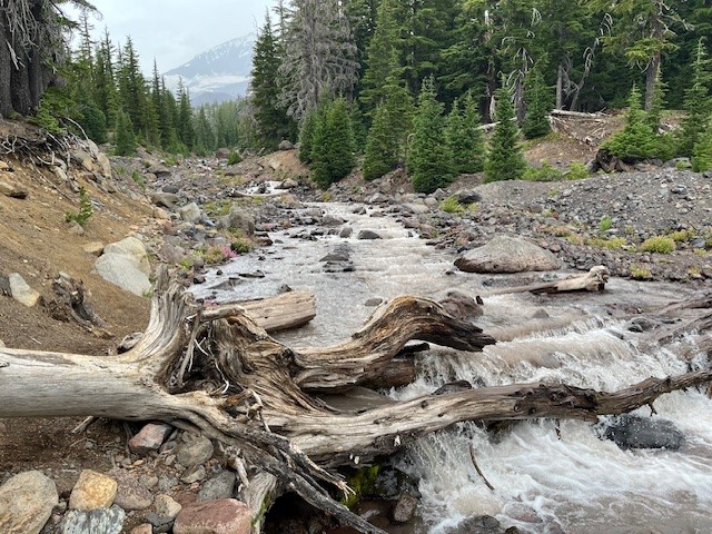
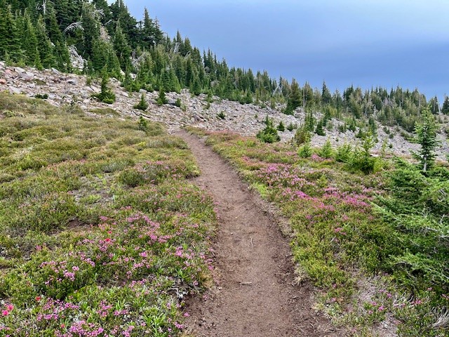
Tackling the creek (the North Fork of Whychus) can be challenging. In 2024, the natural log bridge which had provided a way across was broken and covered with water. Hikers need to walk upstream to find a safe place to step across via rocks in order to access the path on the other side of the creek. Past the creek, the hike climbs into new forested and alpine areas, some covered with wildflowers.
 |
 |
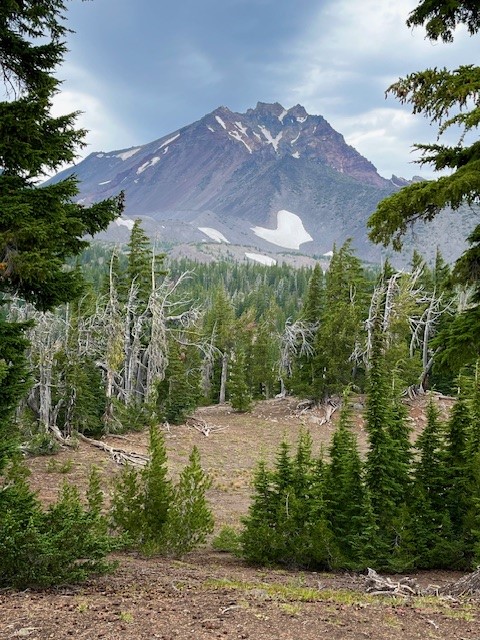 Throughout the hike, the views towards North, Middle and South Sister tower over the landscape and seeing them close is fascinating. Being able to pick out glaciers and streams and evidence of avalanches - along with ski tracks down snowfields from adventurous daredevils, can create a lot of conversation and wonder.
Arriving at Camp Lake in August, 2024, the weather was windy and cooler than in past years. Many who come this distance will camp overnight, exploring nearby Chambers Lake or other trails in the area. Some have been observed climbing Middle Sister as well from the lake. For those who wish to return in a day, after a rest at Camp Lake, the hike back to the Pole Creek Trailhead goes fairly fast as it is mostly downhill. Doing the hike in a day will result in 15 miles and around 2150 feet in elevation gain.
26
Hike Tam McArthur Rim to Broken Top For the Views and Experience
Besides the lake, many will take the 5.3 mile round trip hike (permit required) above the lake to Tam McArthur Rim, gaining over 1200 feet in elevation to reach the rim. Typically the views from this spot are clear from Broken Top and the Three Sisters all the way to Mt. Hood. However, in recent years summer forest fires have added haze and smoke often obstructing the views.
 |
 |
On July 20, 2024, the day started with a slight haze but by the end of the day, the smoke from forest fires settled into the area. However, the hike to Tam McArthur Rim was uneventful with just a handful of people also taking the same trek.
 |
 |
 |
 |
Past Tam McArthur Rim, the unmaintained trail to Broken Hand and Broken Top had abundant wildflowers for this alpine area as well as heavier snow patches than experienced in past years. The approach to Broken Hand involves scrambling over rocks and climbing several cinder ridges before reaching this rugged, rocky prominence. To pass it this July involved either detouring around the rocky base, hiking over snow fields, or trekking directly over snow on Broken Hand's westside. Either way people needed to be careful to avoid falling and sliding down the snowy hill. The majority of people appeared to be going directly over the snowy side of Broken Hand.
 |
 |
Past Broken Hand, there is a hill to climb to reach a fabulous view point. From here, the cragged top and colorful flanks of Broken Top are very visible (along with ski tracks from recent, ambitious past visitors who must have either rope climbed to the top of Broken Top and rappelled down or else made their was up the very steep side of the mountain to the top of the snow patch and skied down to the lake) as well as snow and ice covered No Name Lake. Besides Broken Top, the Three Sisters are very big and impressive from this view point and Mt. Bachelor and Tumalo Mountain visible in the hazy distance. The hike back to the trail head goes fairly fast as it is mostly downhill. All in all, the entire hike is under eleven miles and about 2150 feet of elevation gain.
 |
 |
Privacy Policy / DMCA Notice / ADA Accessibility