

Posts with tag 'Central Oregon Hikes'
Subscribe and receive email notifications of new blog posts.
 RSS Feed
9
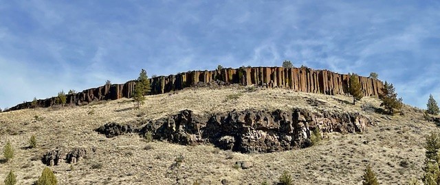
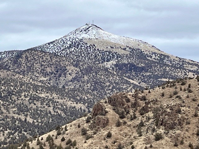
Alder Springs is a Central Oregon High Desert Hike Outside of Sisters
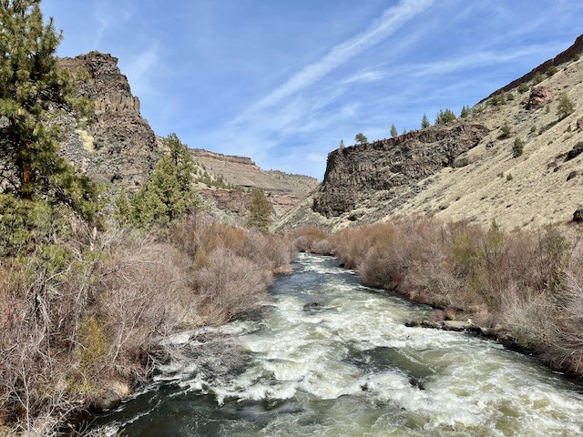
Alder Springs Flows Into Wychus Creek
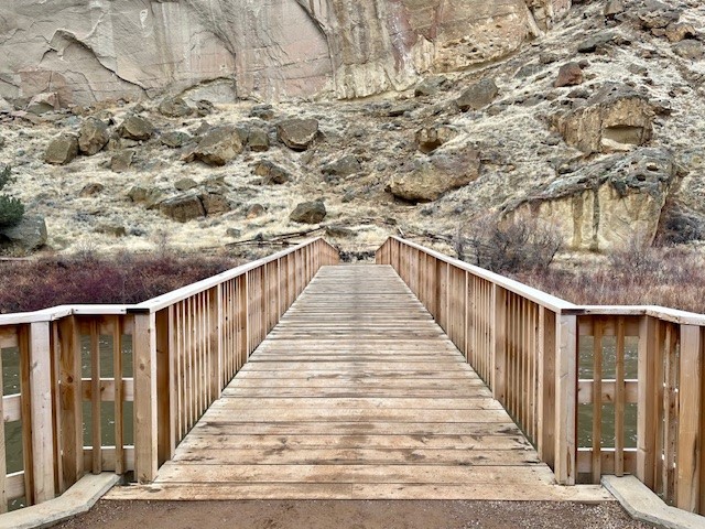
The hike to Alder Springs outside of Sisters limits motorized access from December 1st through March 31st to protect the winter rangeland of the local deer populations. However, access to the trail head is on rough dirt roads for which 4 wheel drive and high vehicle clearance is recommended. Directions to the official trail head can be found on the USDA website. The "unofficial" route involves travel on Locust Street (Camp Polk Road) in Sisters 3.1 miles north from East Cascade Avenue. Take this to Wilt Road, staying on Wilt when the pavement ends 4 miles. Past Rimrock Ranch the road is less maintained. Travel another 2.2 miles until you see a sharp unmarked turnoff to the right onto a rough dirt road. The weekend of April 5, 2025 this road was almost impassible with deep rutted mud which required challenging driving to get through. Travel on this past a gate until you reach a picnic area next to Whychus Creek which provides for a water crossing during dry times of the year. There is a beautiful mesa above the crossing and signage for a Native American archaeological site.
 The early stages of the hike involves traveling next to the creek for a mile, the narrow path following the slope and involving short stretches of climbing followed by level areas. After a mile, the path steepens and hikers travel up the canyon slope and traverse above the river, with several areas close to the steep canyon cliff. Hikers should be careful here. In addition, the open high desert landscape with scattered juniper trees, sagebrush and fescue grass has limited shelter and sun exposure can be an issue with on warm summer days.
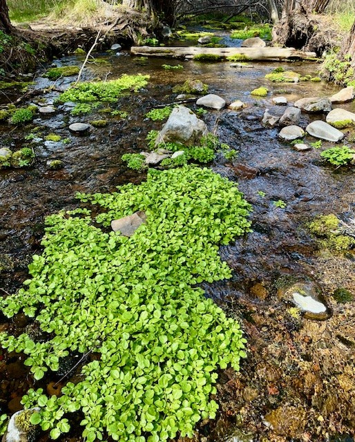
After 4.5 miles, the path drops into the bend of Wychus Creek which also contains Alder Springs. The traditional hike following the Ochoco National Forest website to Alder Springs meets here. Those who hike the recognized path have to wade across Wychus Creek here. In April 2025, the creek was full with the heavy winter snows just starting to melt.
Alder Springs itself is a beautiful oasis of water bubbling up from the ground flowing into Wychus Creek, surrounded by deciduous trees and dogwood, with Seep Monkeyflower growing in bunches on limited higher ground in the springs.
 |
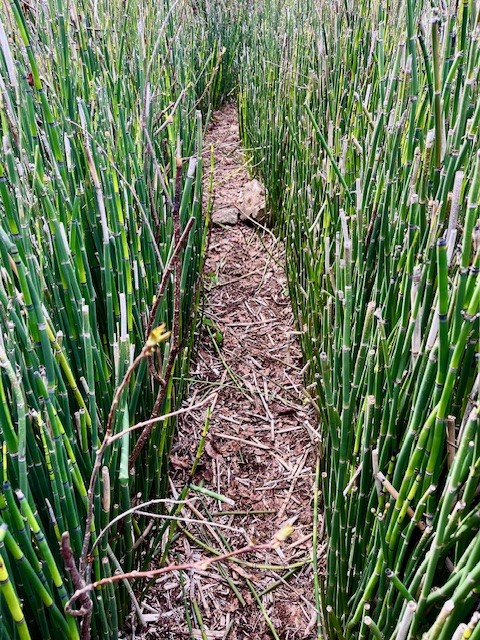 |
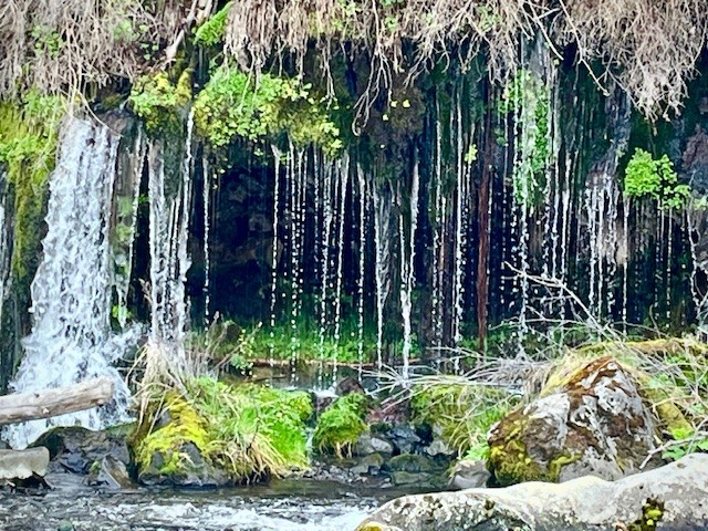
For those who wish to hike the mile and a half to the confluence of Whychus Creek with the Deschutes River, the trail has much heavier vegetation. With few people hiking this area, there are sections of the trail overgrown and hikers have to look out for both rocks which can trip people and branches which can hit heads and bodies. Part of the trail goes through a grove of horsetail. Just before reaching the confluence, there is a beautiful weeping wall with a spring of water flowing into Whychus Creek, resembling a waterfall. Hikers have to know to look for this as access to the view has heavy vegetation and it is difficult to maneuver through this.
At the confluence, beautiful rock canyon walls and a welcoming rock overlooking both rivers make for a great lunch spot. In April 2025 the water levels were very high, higher than seen in earlier years. All in all, the full hike is over 11 miles with just over 1000 feet of gradual elevation gain.
 |
 |
6
Bend Premier Real Estate Welcomes LaRonda Acuff-Sack!
Bend Premier is Pleased to Have LaRonda Acuff-Sack Join the Administrative Team
LaRonda Acuff-Sack, a Bend Oregon native, known for her residential real estate expertise and love of all things local, has been a licensed Real Estate Broker since 1999. She has specialized in listings & new home construction. LaRonda has been a licensed Principal Broker since 2005. She has trained under some of the most renowned sales and marketing trainers in the country and received numerous sales achievement awards including Sales Person of The Year. Well educated in all facets of her profession she has attained Certified New Home Sales Professional certification from the National Association of Home Builders. LaRonda and her husband Joe, an RN at our local hospital, have an "urban farm" in Bends mid-town with a large organic garden and beehives. They enjoy spending time with their family, friends, and beautiful puppy named Ocean. LaRonda could not be more excited to be living and wo...
6
Bend Premier Real Estate | February 2025 Newsletter
What's in the February 2025 Bend Premier Newsletter?
- 2025 Bend Home Sales Have Started With a Bang
- Rich Chocolate Mousse
- Transforming Your Home Into the Ultimate Hangout Spot for the Big Game
- Lower Chush Falls in Winter is Stunning
- Time in the Market Beats Trying to Time the Market
10
Bend Premier Real Estate | January 2025 Newsletter
What's in the January 2025 Bend Premier Newsletter?
- More Inventory and Moderate Price Increase the Norm in 2024
- Creamy Mushroom Pasta
- Cozy Ideas to Transform Your Living Room This Winter
- Hike Smith Rock for a Winter Challenge
- Get Ready to Sell a Home in 2025
8
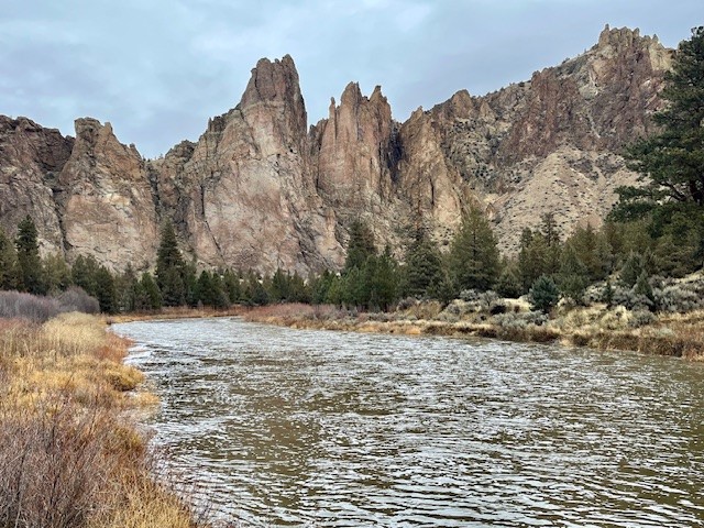
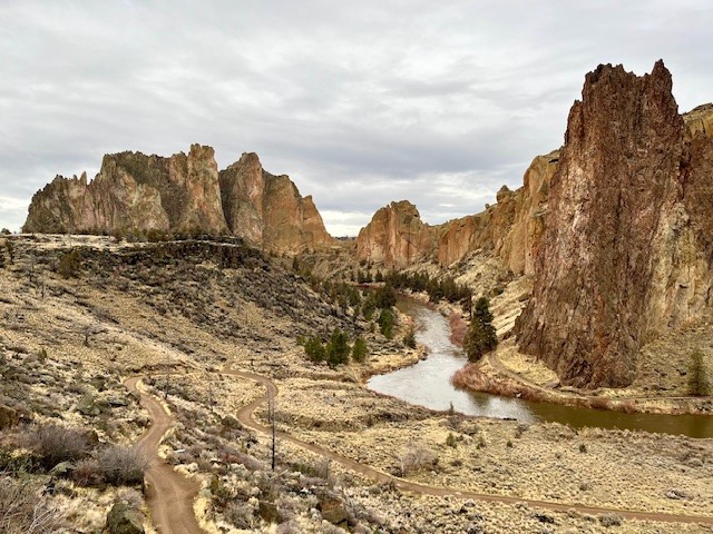
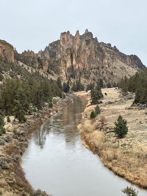
Hike Smith Rock's Burma Road and Misery Ridge Loop for a Great Winter Experience
The Burma Road, Summit Trail, Misery Ridge Loop Can be Challenging
For those looking to undergo a challenging Central Oregon hike when the Cascades are covered with snow, Smith Rock State Park can provide many options. Typically very busy in the summer when rock climbing is at its peak and the weather warm, winter hikes in Smith Rock can be rewarding with fewer crowds and different perspectives of the rocks. Before sections of the park are shut off in the spring due to falcon nesting, hikers can explore little known social trails and see portions of the park rarely visited. However, for those who wish to exert themselves, hiking along the Wolf Creek trail until connecting with Burma Road, climbing it and then hiking the north side of the park along the Summit Trail, then up Mesa Verde until connecting with Misery Ridge and climbing the backside past Monkey Face to the summit until returning down to Crooked River and then up the canyon to the parking lot can be a fulfilling winter hike of over six miles and close to 1800 feet of elevation gain. During the winter, sometimes weather conditions can create icy patches, so microspikes and trekking poles can be helpful. But if the weather cooperates, the Burma Road, Misery Ridge Loop can be a wonderful challenge.
 |
 |
 |
 |
Privacy Policy / DMCA Notice / ADA Accessibility