

Posts from August 2024
Subscribe and receive email notifications of new blog posts.
 RSS Feed
14
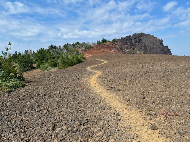
Black Crater is More About the Destination Than the Journey
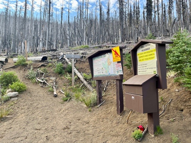
Black Crater Trailhead is Located off McKenzie Hwy 242
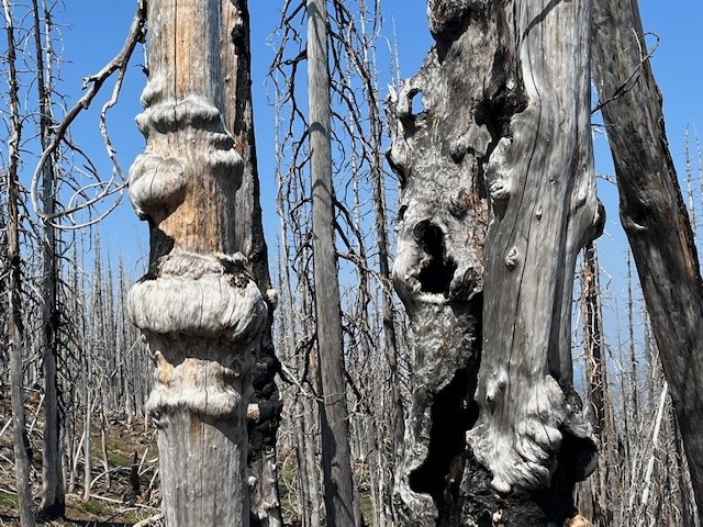
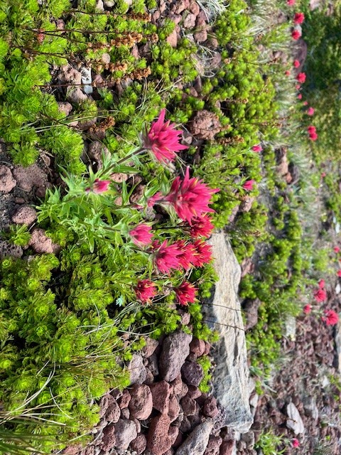
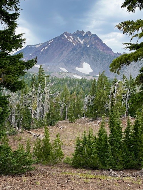
For those wanting a relatively short hike which provides for a lot of elevation gain, Black Crater is one of the best. Located off McKenzie Hwy 242, the hike is limited to the summer season when McKenzie Hwy opens each year. Unfortunately, the 2017 Milli fire burned a lot of the forest on McKenzie Hwy, and the lower slopes of Black Crater were impacted. In the seven years since the Milli fire, manzanita, certain grasses, some wildflowers, and young trees have begun to grow in the dead landscape, but it will take decades until the cinder cone is entirely forested again. The one advantage of the burned forest is the views toward Mt. Washington are far more visible in the lower elevations than they would have been eight years ago.
 |
 |
 |
 |
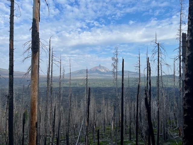
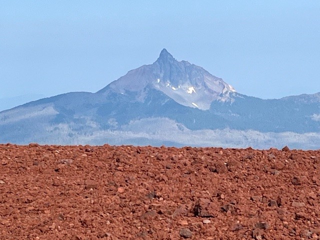
Roughly two and a half miles into the hike, the burned forest is left and the steep path zigzags through mixed forest and cinder fields. And at three and a half miles, hikers reach the top. The views on a clear day towards The Three Sisters, Broken Top, Mt Jefferson, Mt Washington, and all the hills in McKenzie Pass are fabulous. Plus hikers have the satisfaction of having climbed over 2300 feet to reach the top. The hike down goes faster than the up and many can complete the entire hike, without really pushing, in a little over three hours.
 |
 |
14
Is Bend Home Affordability Starting To Improve?
Over the past couple of years, a lot of people have had a hard time buying a Bend home. And while affordability is still tight, there are signs it's getting a little better and might keep improving throughout the rest of the year. Lawrence Yun, Chief Economist at the National Association of Realtors (NAR), says:
"Housing affordability is improving ever so modestly, but it is moving in the right direction."
Here's a look at the latest data on the three biggest factors affecting home affordability: mortgage rates,
13
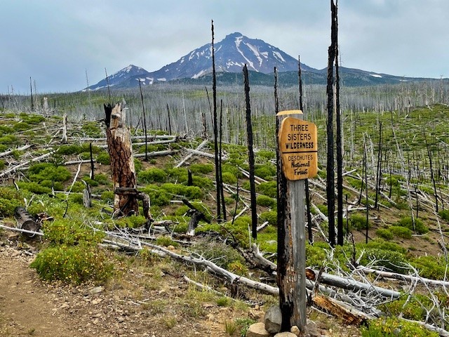
Few Hike to Camp Lake - But it is Worth it!
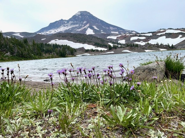
Camp Lake is at the Base of South Sister
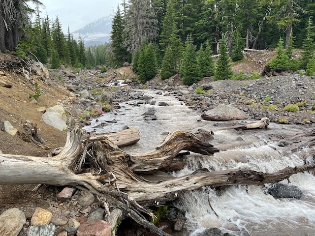
Although many will hike to Green Lakes and enjoy the experience of the lakes in the valley between South Sister and Broken Top, relatively few hike to Camp Lake and see South Sister so close from the north. The hike to Camp Lake (Pole Creek trailhead just outside of Sisters) takes you through several miles of burned forest before hikers enter living forest, so it can be hot and dusty in the summer. However, once hikers reach unburned trees, the hike becomes more pleasant. In recent years, the fallen trees of the burned forest have been cleared from the path, so scrambling over, under and around fallen logs was not an issue in 2024.
On August 3, 2024, the air in Central Oregon was better than it had been earlier in the week (many Oregon forest fires have impacted air quality), so the hike to Camp Lake was relatively clear. Views of North and Middle Sister stood out among the dead forest, but it was also interesting to see the new growth in acres of manzanita, grasses, some wildflowers, and young trees.
 |
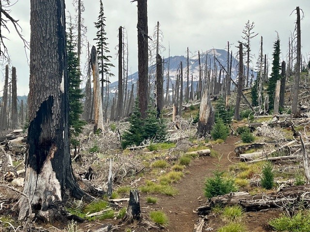 |
Tackling the creek (the North Fork of Whychus) can be challenging. In 2024, the natural log bridge which had provided a way across was broken and covered with water. Hikers need to walk upstream to find a safe place to step across via rocks in order to access the path on the other side of the creek. Past the creek, the hike climbs into new forested and alpine areas, some covered with wildflowers.
 |
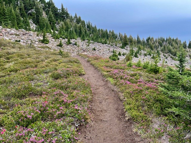 |
 Throughout the hike, the views towards North, Middle and South Sister tower over the landscape and seeing them close is fascinating. Being able to pick out glaciers and streams and evidence of avalanches - along with ski tracks down snowfields from adventurous daredevils, can create a lot of conversation and wonder.
Arriving at Camp Lake in August, 2024, the weather was windy and cooler than in past years. Many who come this distance will camp overnight, exploring nearby Chambers Lake or other trails in the area. Some have been observed climbing Middle Sister as well from the lake. For those who wish to return in a day, after a rest at Camp Lake, the hike back to the Pole Creek Trailhead goes fairly fast as it is mostly downhill. Doing the hike in a day will result in 15 miles and around 2150 feet in elevation gain.
12
Bend Premier Real Estate | August 2024 Newsletter
What's in the August 2024 Bend Premier Newsletter?
- Bend Real Estate Sales at a Crossroads
- Avocado Peach Salsa
- August Home Maintenance Checklist
- Hike Cooper Spur on Mt Hood
- Home Inspections for Sellers: How to Prepare
8
Bend Oregon Real Estate | July 2024 Trends
Bend Real Estate Sales at a Crossroads
The data has been published and the trends we have seen for many years for Bend home sales have changed. Instead of seeing home sales prices increasing year over year, in July 2024 home sales prices decreased year over year. This change directly reflects on the increased inventory levels the town has experienced in the last few months. The Covid pandemic resulted in tremendous dema...
Privacy Policy / DMCA Notice / ADA Accessibility