

Posts from April 2024
Subscribe and receive email notifications of new blog posts.
 RSS Feed
8
Alder Springs is a Little Known Central Oregon Hike
Hike Alder Springs Ideally in Fall or Spring
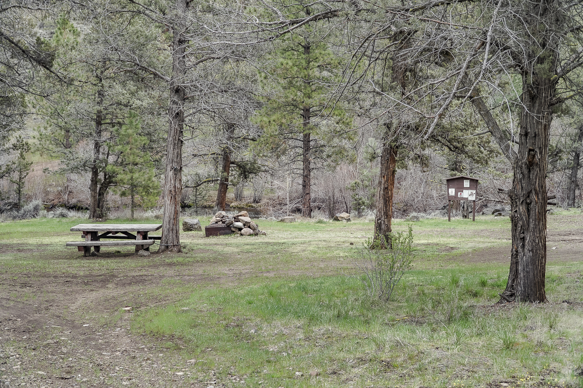
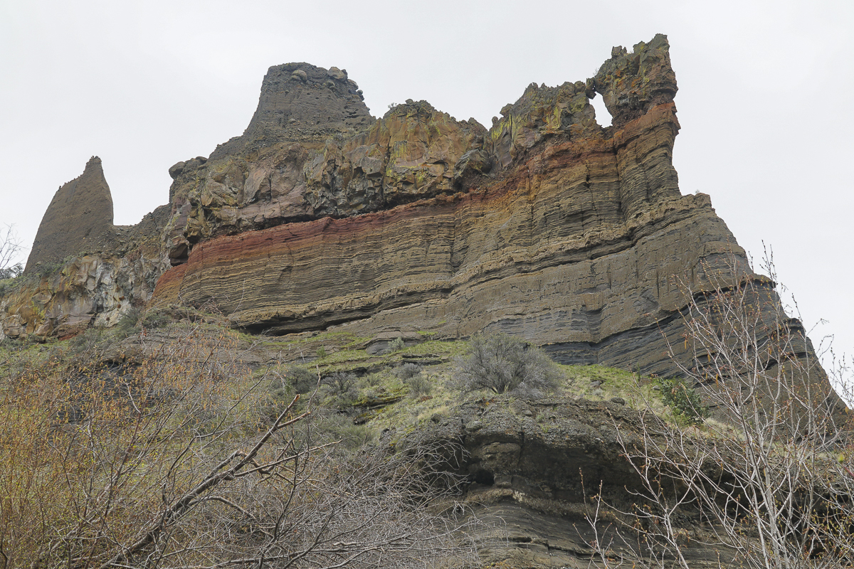
The hike to Alder Springs outside of Sisters limits motorized access from December 1st through March 31st to protect the winter rangeland of the local deer populations. However, access to the trail head is on rough dirt roads for which 4 wheel drive and high vehicle clearance is recommended. Directions to the official trail head can be found on the USDA website. The "unofficial" route involves travel on Locust Street (Camp Polk Road) in Sisters 3.1 miles north from East Cascade Avenue. Take this to Wilt Road, staying on Wilt when the pavement ends 4 miles. Past Rimrock Ranch the road is less maintained. Travel another 2.2 miles until you see a sharp unmarked turnoff to the right onto a rough dirt road. Travel on this past a gate until you reach a picnic area next to Whychus Creek which provides for a water crossing during dry times of the year. There is a beautiful mesa above the crossing and signage for a Native American archaeological site.
 |
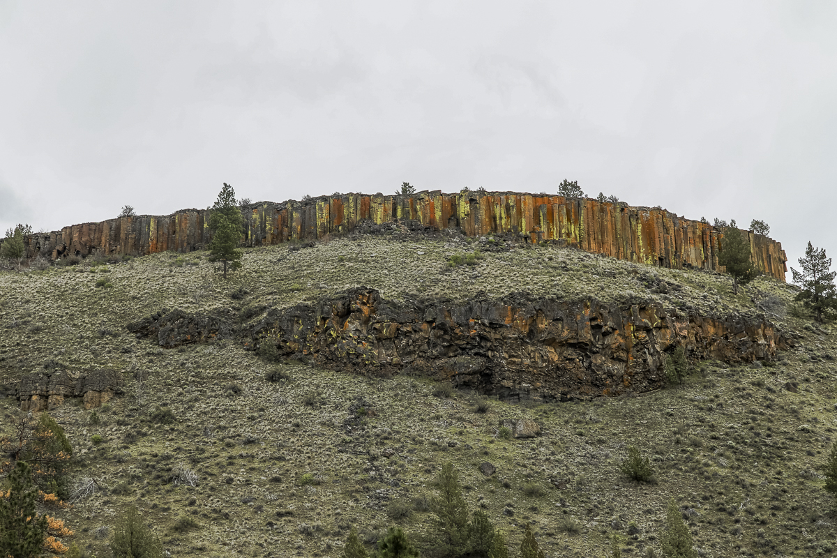 |
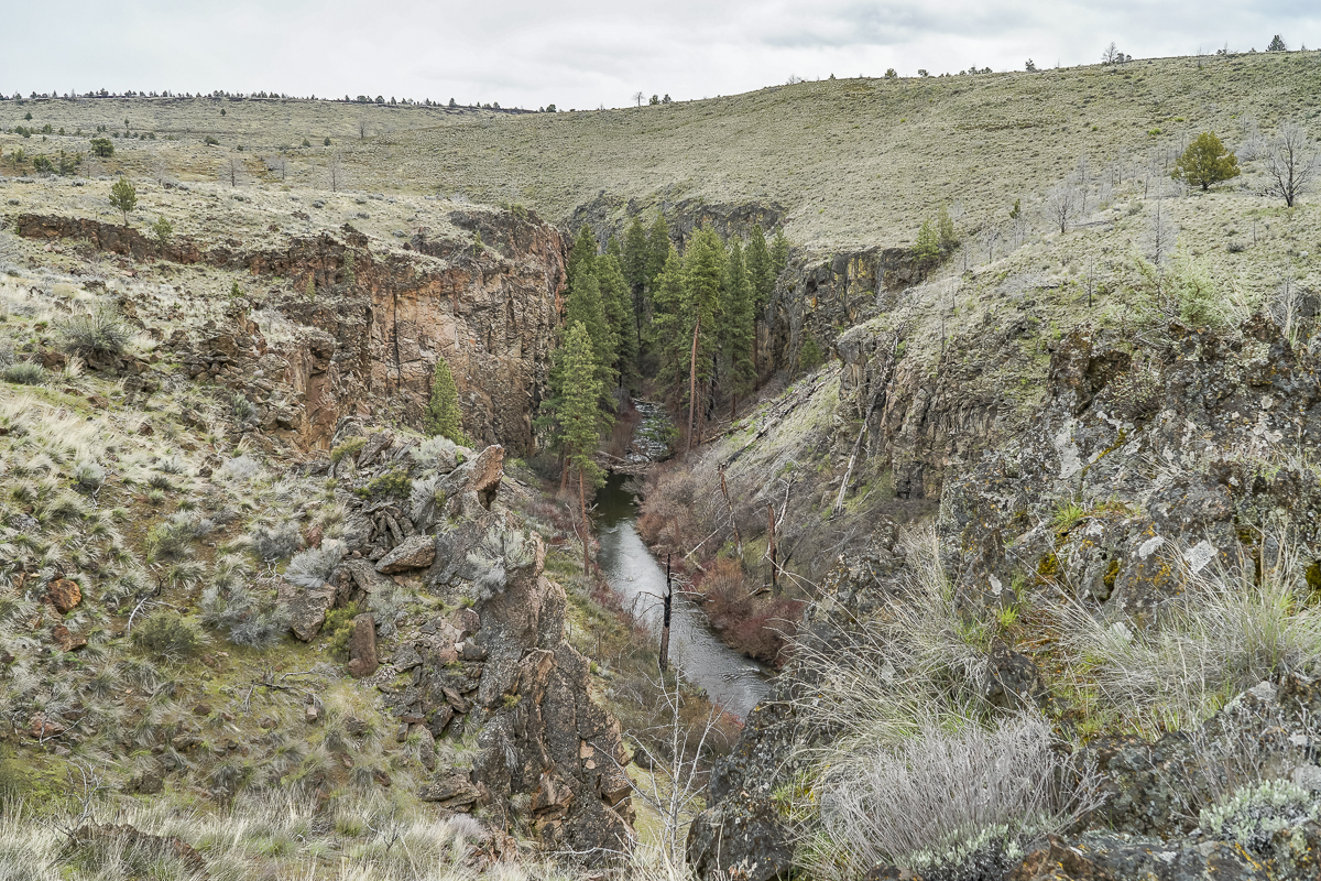
The unofficial trail parallels Whychus Creek for over 3.5 miles from the picnic area down the western side of Whychus Canyon eventually dropping to Alder Springs. The trail has some sections which are difficult to locate and other areas where the tract comes close to the canyon rim and the steep drop to the creek. In the summer the exposure with limited trees would make the hike very warm; hikers should be careful to bring plenty of water. Alder Springs is where the "official" trail crosses Whychus Creek and hikers using this trail need to wade across the stream to go any further; in April the water is cold.
 |
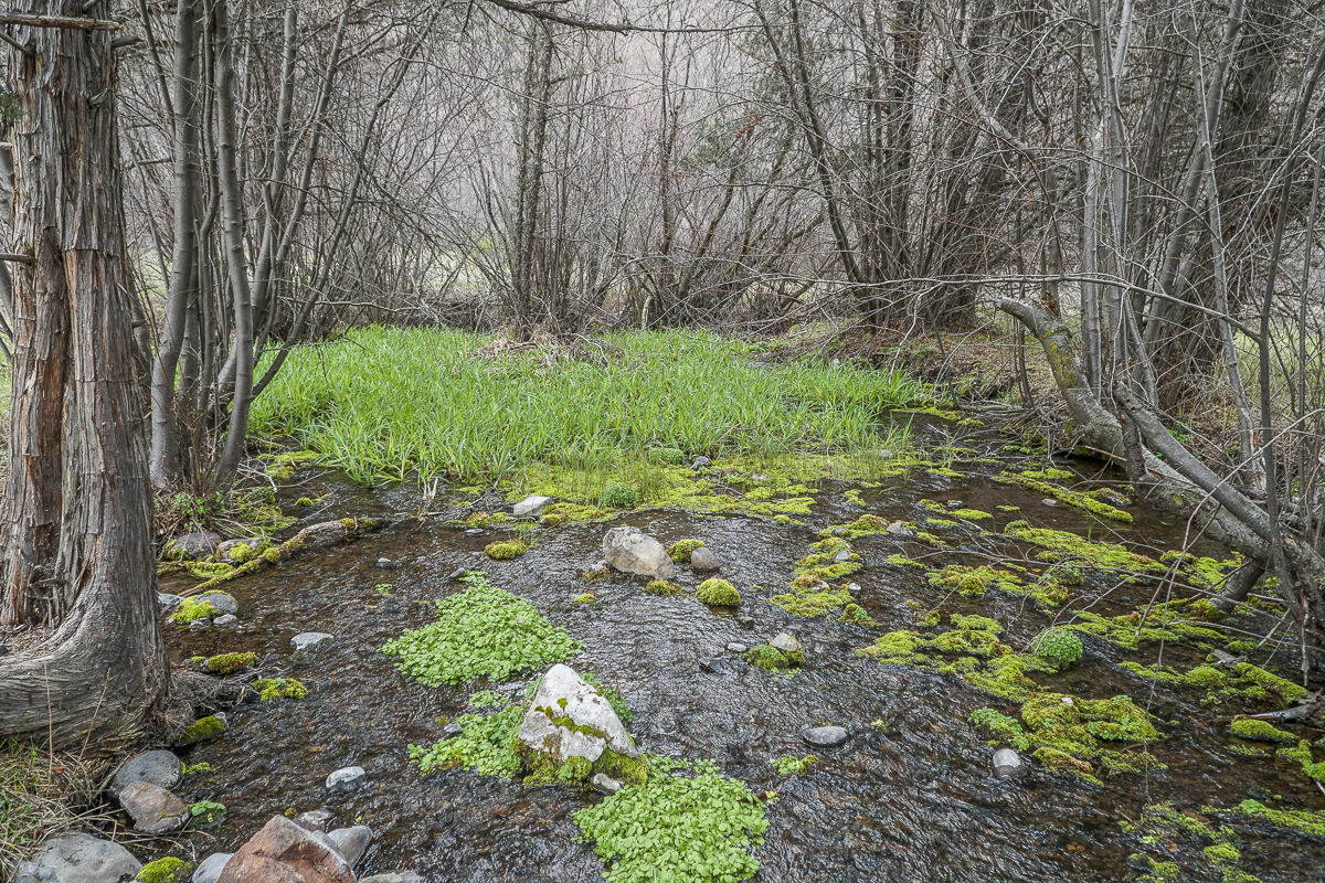 |
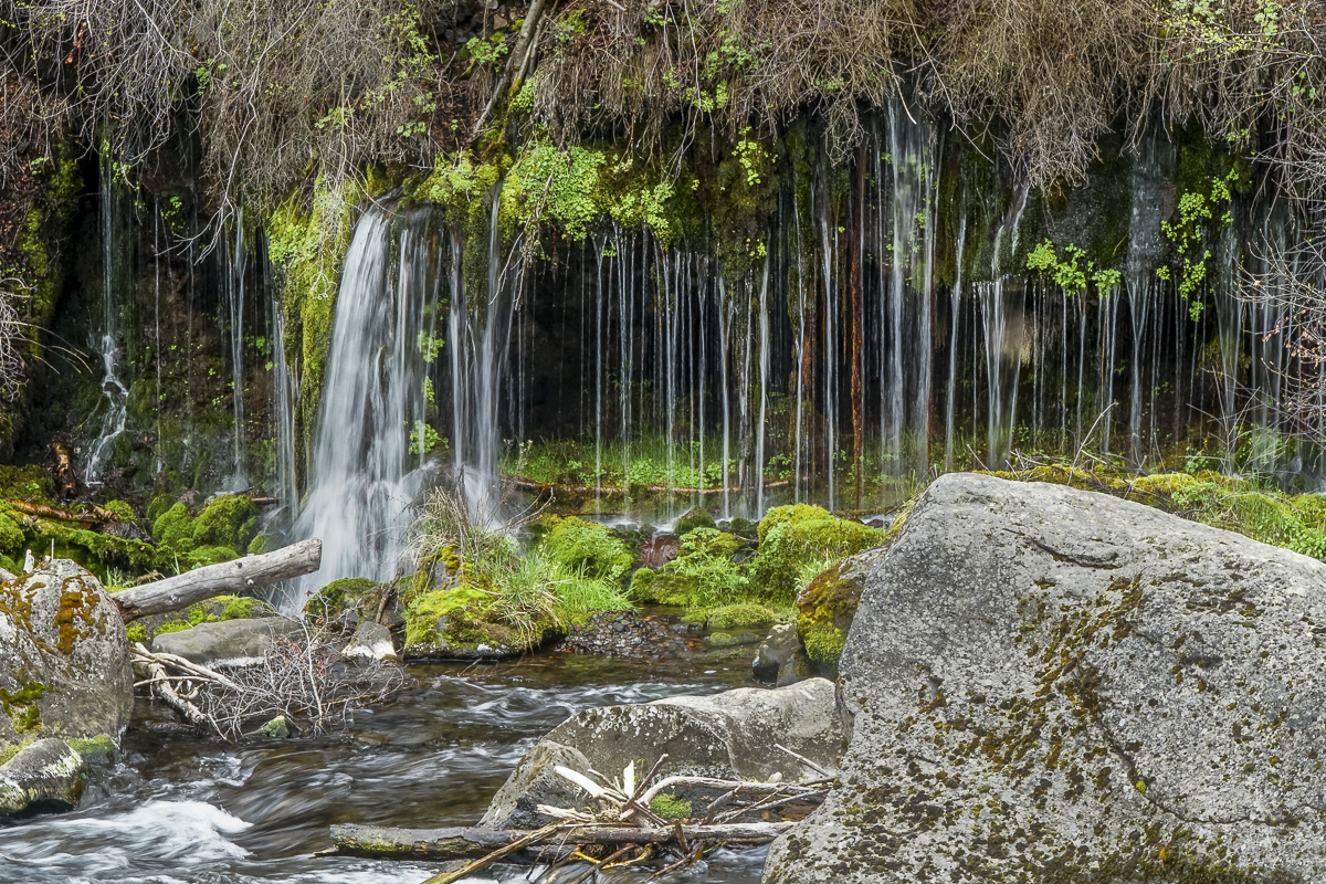
Hikers can enjoy the shade from the many trees and the water bubbling up from rocks at Alder Springs, eventually flowing into Whychus Creek. Or they can continue down Whychus Creek another 1.5 miles to the confluence of the creek with the Deschutes River. This section of the hike has far more vegetation which creates more shade, but also more obstacles to push aside, walk around or over. Close to the confluence is a stone cliff from which a spring flows creating a lovely waterfall. Access to this involves stepping around shrubs and trees to see it and as the vegetation grows later in the spring, many hikers will probably miss the waterfall as it will be hidden from the path. At the confluence, a large rock formation provides the perfect space for lunch and enjoyment of the flowing water and towering rock formations.
 |
 |
All in all, traveling the unofficial route will take more time, but the beauty of the high desert is very much displayed during the hike. Just over 1000 feet of elevation change, 11+ miles, and keeping feet dry make this unofficial route to Alder Springs a wonderful spring or late fall hike.
4
Bend Oregon Real Estate | March 2024 Trends
Bend Home Prices Up and Inventory Levels Down
Despite the trends for January and February 2024 in which prices seemed to stabilize, the sales price of Bend homes rose unexpectedly in March. The year over year figure shows both median and average Bend home prices were up over 12% and inventory levels were down. When coupled with the steep rise in prices, affordability remains a major problem for potential Bend home buyers.
When March 2024 is compared with March 2023 for Bend single family homes on less than an acre, the following trends are noted:
- Average sales price up 12% to $893,967*
- Median sales price up 13.2% to $760,000
- Average list price up 9....
3
Why Overpricing Your Bend Home Can Cost You
If you're trying to sell your Bend Oregon house, you may be looking at this spring season as the sweet spot – and you're not wrong. We're still in a seller's market because there are so few Bend homes for sale right now. And historically, this is the time of year when more buyers move, and competition ticks up. That makes this an exciting time to put up that for sale sign.
But while conditions are great for sellers like you, you'll still want to be strategic when it comes time to set...
Privacy Policy / DMCA Notice / ADA Accessibility